Category:GMS Display Options: Difference between revisions
From XMS Wiki
Jump to navigationJump to search
No edit summary |
No edit summary |
||
| Line 2: | Line 2: | ||
[[Category:GMS General Information|D]] | [[Category:GMS General Information|D]] | ||
[[Category:Display Options|G]] | |||
Latest revision as of 19:22, 25 February 2014
Articles relating to display options in GMS.
Pages in category "GMS Display Options"
The following 33 pages are in this category, out of 33 total.
D
M
Media in category "GMS Display Options"
The following 66 files are in this category, out of 66 total.
- 2D Mesh Icon.svg 56 × 60; 4 KB
- 2D Scatter Icon.svg 60 × 60; 4 KB
- 3D Grid Icon.svg 60 × 60; 6 KB
- 3D Mesh Icon.svg 60 × 60; 5 KB
- 3D Scatter Icon.svg 60 × 60; 9 KB
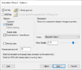
- AnimationWizard.png 479 × 411; 20 KB
- Axes Icon.svg 48 × 52; 4 KB
- Borehole Module Icon.svg 58 × 60; 6 KB
- Circum.png 446 × 294; 3 KB
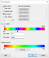
- ColorOptions.png 398 × 471; 17 KB
- Contour Line Bold Options.png 244 × 203; 4 KB
- Contour Optns Value Population Method.png 350 × 211; 5 KB
- Contour w tri.png 465 × 342; 22 KB
- Contour wo tri.png 468 × 344; 9 KB
- ContourLabelOptions.png 416 × 320; 8 KB
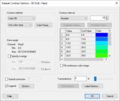
- ContourOptions1.png 583 × 490; 11 KB
- Create Cross Section Tool.svg 60 × 52; 4 KB
- Display2DGrid.png 733 × 573; 41 KB
- Display2Dmesh.png 733 × 573; 37 KB
- Display2DScatter.png 733 × 573; 27 KB
- Display3DGrid.png 733 × 573; 46 KB
- Display3DGridMODFLOW.jpg 733 × 573; 103 KB
- Display3DGridParticle.jpg 733 × 573; 104 KB
- Display3DMesh.png 733 × 573; 41 KB
- Display3DScatter.png 733 × 573; 28 KB
- Display3DUGrid.png 733 × 573; 36 KB
- DisplayBorehole.png 733 × 573; 42 KB
- DisplayDrawing.png 733 × 573; 23 KB
- DisplayGIS.png 733 × 573; 20 KB
- DisplayLighting.png 733 × 573; 38 KB
- DisplayMap.png 733 × 573; 49 KB
- DisplayMaterials.png 733 × 573; 20 KB
- DisplayMODAEM.jpg 733 × 573; 67 KB
- DisplaySolid.png 733 × 573; 22 KB
- DisplayTIN.png 733 × 573; 30 KB
- Drawing Grid Icon.svg 64 × 60; 4 KB
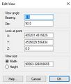
- EditAngle.jpg 258 × 304; 24 KB
- Geos2d b.png 1,440 × 900; 313 KB
- Geos2d w.png 1,440 × 900; 315 KB
- GIS Module Icon.svg 60 × 60; 381 KB
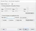
- GMS AnimationWizard CrossSctns Isosrfces.png 479 × 411; 18 KB
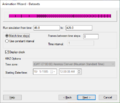
- GMS AnimationWizard Datasets.png 479 × 411; 17 KB
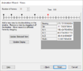
- GMS AnimationWizard Views.png 479 × 411; 19 KB
- GMS Axes Display 10.png 733 × 573; 22 KB
- GMS Display Theme.png 553 × 433; 29 KB
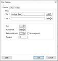
- GMS Plot Options Optns.jpg 412 × 439; 33 KB
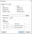
- GMS Plot Options X Axis.jpg 412 × 439; 46 KB
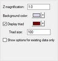
- GMSDisplayGeneralOptions.jpg 201 × 213; 14 KB
- Lighting Options macro.png 16 × 16; 600 bytes
- Lighting Options Macro.svg 48 × 60; 8 KB
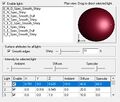
- LightingDialog.jpg 455 × 387; 60 KB
- Logcont.jpg 385 × 490; 28 KB
- Map Module Icon.svg 52 × 56; 4 KB
- Map Module.png 16 × 16; 597 bytes
- NewPalette.png 289 × 221; 7 KB
- Raster Module icon.png 15 × 15; 660 bytes
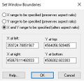
- SetWindowBoundaries.jpg 271 × 259; 31 KB
- Solid Module Icon.svg 60 × 60; 5 KB
- Thiessen.png 453 × 300; 9 KB
- TIN Module Icon.svg 60 × 60; 4 KB
- TIN Module Inactive Icon.svg 60 × 60; 3 KB
- UgridCrossSectionOptions GMS.png 573 × 289; 13 KB
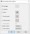
- UGridCrossSectionOtherOptions GMS.png 346 × 388; 11 KB
- UGridCrossSectionParameters GMS.png 306 × 242; 11 KB
- VectorOptions.jpg 466 × 380; 52 KB
- WMSIcon GIS Module.png 16 × 16; 767 bytes
