Category:WMS Coverages: Difference between revisions
From XMS Wiki
Jump to navigationJump to search
(Created page with "Articles related to coverages in WMS. Category:WMS Map") |
No edit summary |
||
| (One intermediate revision by the same user not shown) | |||
| Line 1: | Line 1: | ||
Articles related to coverages in WMS. | Articles related to coverages in WMS. | ||
[[Category:WMS Map]] | [[Category:WMS Map|C]] | ||
[[Category:Map Module]] | |||
Latest revision as of 15:52, 17 November 2016
Articles related to coverages in WMS.
Pages in category "WMS Coverages"
The following 19 pages are in this category, out of 19 total.
1
Media in category "WMS Coverages"
The following 14 files are in this category, out of 14 total.
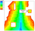
- ClassifiedFloodDepthMap.png 375 × 208; 31 KB
- CoverageMenu1.jpg 202 × 198; 18 KB
- CoverageMenu2.jpg 421 × 592; 72 KB
- CoverageMenu3.jpg 204 × 198; 19 KB
- DelineatedFloodPlainDepthContours.png 367 × 221; 55 KB
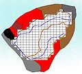
- DelineationFloodBarrier.png 343 × 307; 39 KB
- DelineationFlowPaths.png 341 × 307; 35 KB
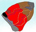
- DelineationNoConsideration.png 344 × 308; 34 KB
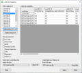
- LandUseAtts.png 652 × 581; 54 KB
- Overlay1.jpg 356 × 318; 24 KB
- Overlay2.jpg 356 × 321; 31 KB
- Overlay3.jpg 379 × 334; 30 KB
- SampleTIN DelineationOptions.png 302 × 299; 109 KB
- WMS Coverage Overlay.png 340 × 523; 22 KB

