GMS:HydroGeoSphere Point Properties: Difference between revisions
From XMS Wiki
Jump to navigationJump to search
No edit summary |
No edit summary |
||
| Line 4: | Line 4: | ||
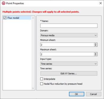
[[File:HGS point prop.png|thumb|350 px|''Point Properties'' dialog for the boundary conditions coverage]] | [[File:HGS point prop.png|thumb|350 px|''Point Properties'' dialog for the boundary conditions coverage]] | ||
==Flux Nodal | ==Flux Nodal== | ||
Flux nodal is a general specified flux boundary condition for a point on the boundary conditions coverage of a HydroGeoSphere model. The input options for a flux nodal designation are listed below. | Flux nodal is a general specified flux boundary condition for a point on the boundary conditions coverage of a HydroGeoSphere model. The input options for a flux nodal designation are listed below. | ||
* ''Name'' – The name of the boundary condition. Names should be unique and contain no white space. | * ''Name'' – The name of the boundary condition. Names should be unique and contain no white space. | ||
| Line 22: | Line 22: | ||
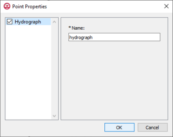
[[File:HGS point prop hydrograph.png|thumb|350px|''Point Properties'' dialog for the hydrograph coverage]] | [[File:HGS point prop hydrograph.png|thumb|350px|''Point Properties'' dialog for the hydrograph coverage]] | ||
==Hydrograph | ==Hydrograph== | ||
GMS allows recording of hydrograph data on a point from the HydroGeoSphere model run. This requires that "Hydrograph" is set as the parameter for a point on a HydroGeoSphere hydrograph coverage, which is done inside the ''Point Properties'' dialog. The coverage then needs to be added to the simulation. Upon the simulation run, GMS will output detailed flow rate information at each time step for each point that has been assigned a hydrograph. The only input available in the ''Point Properties'' dialog on a hydrograph coverage is a name. The name should be something descriptive, and less than 80 characters. | GMS allows recording of hydrograph data on a point from the HydroGeoSphere model run. This requires that "Hydrograph" is set as the parameter for a point on a HydroGeoSphere hydrograph coverage, which is done inside the ''Point Properties'' dialog. The coverage then needs to be added to the simulation. Upon the simulation run, GMS will output detailed flow rate information at each time step for each point that has been assigned a hydrograph. The only input available in the ''Point Properties'' dialog on a hydrograph coverage is a name. The name should be something descriptive, and less than 80 characters. | ||
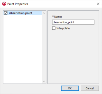
[[File:HGS point prop obs.png|thumb|350px|''Point Properties'' dialog for the observation coverage]] | [[File:HGS point prop obs.png|thumb|350px|''Point Properties'' dialog for the observation coverage]] | ||
==Observation | ==Observation== | ||
GMS allows recording of observation data from the HydroGeoSphere model run through observation points on a HydroGeoSphere observations coverage. When an observation point is created, GMS outputs timeseries information specific to the observation point during the simulation run. To create an observation point, select a point to designate as an observation point and set the parameters inside the ''Point Properties'' dialog. The input options for an observation point are listed below. | GMS allows recording of observation data from the HydroGeoSphere model run through observation points on a HydroGeoSphere observations coverage. When an observation point is created, GMS outputs timeseries information specific to the observation point during the simulation run. To create an observation point, select a point to designate as an observation point and set the parameters inside the ''Point Properties'' dialog. The input options for an observation point are listed below. | ||
* ''Name'' – This should be a descriptive name for the observation point, and less than 40 characters. | * ''Name'' – This should be a descriptive name for the observation point, and less than 40 characters. | ||
Revision as of 15:04, 2 May 2024


