GMS:Boreholes
The Borehole module of GMS can be used to visualize boreholes created from drilling logs and to construct three-dimensional cross sections between boreholes. These cross sections show the soil stratigraphy between two boreholes.
Types of Borehole Data
A borehole can contain either stratigraphy data or sample data or both.
Stratigraphy
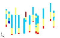
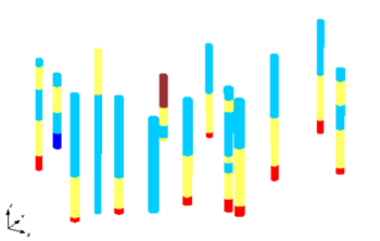
Stratigraphy data are used to represent soil layers that are encountered in a soil boring. The soil layers are represented using contacts and segments as shown below. A segment represents a soil layer and a contact is the interface between two segments.
Sample Data
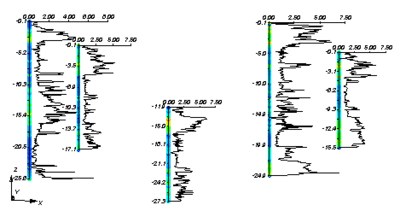
Sample data represent data obtained by continuous sampling along the length of the hole. Cone penetrometer data and down-hole geophysical data are examples of sample data. The figure below shows an example of sample data being displayed. Sample data are stored in datasets which can be manipulated in a similar fashion as other datasets in GMS.
| GMS – Groundwater Modeling System | ||
|---|---|---|
| Modules: | 2D Grid • 2D Mesh • 2D Scatter Point • 3D Grid • 3D Mesh • 3D Scatter Point • Boreholes • GIS • Map • Solid • TINs • UGrids | |
| Models: | FEFLOW • FEMWATER • HydroGeoSphere • MODAEM • MODFLOW • MODPATH • mod-PATH3DU • MT3DMS • MT3D-USGS • PEST • PHT3D • RT3D • SEAM3D • SEAWAT • SEEP2D • T-PROGS • ZONEBUDGET | |
| Aquaveo | ||


