SMS:BOUSS-2D Probes
BOUSS-2D Probe Manager
BOUSS-2D can output the histories of the computed water-surface elevation, velocities, force, and pressure at every grid point and at every time-step. However, due to the number of data points in the domain, this is usually done at intervals of 15-30 min.
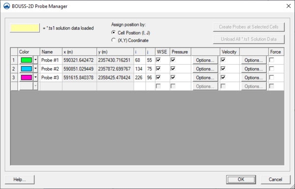
In order to provide a more complete temporal representation of the results of the calculation, the model allows the user to specify probes. At a probe location (x,y,z) the user can specify what data should be saved and at what temporal resolutions. The options include water surface, velocity, force, and pressure.
The probe manager allows creating, editing, and deleting probes. This dialog is only accessible when a BOUSS-2D grid exists. The properties associated with probes are color, name, location, water surface elevation (WSE), pressure, force, and velocity.
Related Topics
SMS – Surface-water Modeling System | ||
|---|---|---|
| Modules: | 1D Grid • Cartesian Grid • Curvilinear Grid • GIS • Map • Mesh • Particle • Quadtree • Raster • Scatter • UGrid |  |
| General Models: | 3D Structure • FVCOM • Generic • PTM | |
| Coastal Models: | ADCIRC • BOUSS-2D • CGWAVE • CMS-Flow • CMS-Wave • GenCade • STWAVE • WAM | |
| Riverine/Estuarine Models: | AdH • HEC-RAS • HYDRO AS-2D • RMA2 • RMA4 • SRH-2D • TUFLOW • TUFLOW FV | |
| Aquaveo • SMS Tutorials • SMS Workflows | ||
