GMS:Bounding Grid
From XMS Wiki
Jump to navigationJump to search
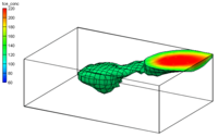
In many cases, it is useful to interpolate to a 3D grid which just contains the points from a 3D scatter set. The Bounding Grid command was designed in order to simplify the creation of such a grid. Selecting the Bounding Grid command from the Scatter Points menu, brings up the Create Grid dialog pre-filled with grid dimensions set to 10% beyond the bounds of the active scatter point set.
| [hide] GMS – Groundwater Modeling System | ||
|---|---|---|
| Modules: | 2D Grid • 2D Mesh • 2D Scatter Point • 3D Grid • 3D Mesh • 3D Scatter Point • Boreholes • GIS • Map • Solid • TINs • UGrids | |
| Models: | FEFLOW • FEMWATER • HydroGeoSphere • MODAEM • MODFLOW • MODPATH • mod-PATH3DU • MT3DMS • MT3D-USGS • PEST • PHT3D • RT3D • SEAM3D • SEAWAT • SEEP2D • T-PROGS • ZONEBUDGET | |
| Aquaveo | ||
