Arcs from Points Tool
This is the approved revision of this page, as well as being the most recent.
Arcs from Points
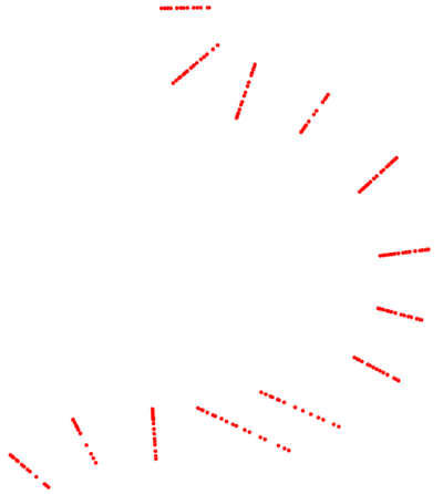
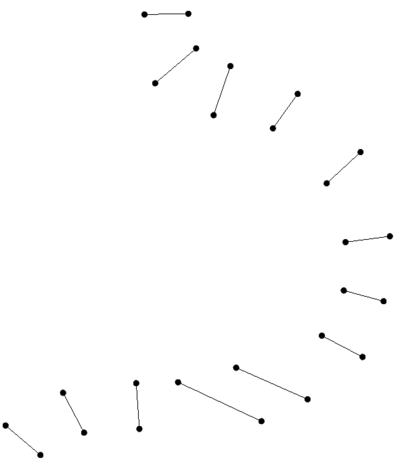
The Arcs from Points tool creates a set of arcs which connect naturally neighboring points in a point set into arcs/polylines. The point set can be provided in the form of a set of scatter points vertices, mesh nodes, or UGrid points, a new coverage consisting of arcs is created and loaded into the XMS project.
The user provides a set of points that should be connected into arcs. The user also specifies the number of nearest neighbors to check for connections. Additionally, the user has an option to specify a maximum distance to be considered a connection point. The tool works by finding the closest N neighbors, based on the N value specified by the user and the distance to each of these neighbors. It then starts with the closest points and builds arcs by finding neighboring points that are closest to each other.
Two example applications of this tool include:
- This tool can be used to create cross sections from disjoint survey points
- This tool can be used to create a levee centerline from survey points along the crest
Input Parameters
- Input grid – geometry (scatter set, 2D mesh, UGrid) - This parameter is the geometry that provides the point locations that are to be connected into arcs.
- Number of nearest neighbors – An integer which must be 2 or greater. The lower the number, the faster the algorithm works. As the number increases, more potential connections can be found. The default is 5 which should be sufficient for almost all cases.
- Connect isolated points – boolean - this enables an option to connect disjoint nodes into the nearest arc at the end the arc definition process. This defaults to off. It was included for a customized workflow and generally should not be enabled. In the future, this may be expanded to allow the creation of networks.
- Enforce max distance – boolean - this turns on the use of a maximum distance to find neighbors. If the option, which defaults to OFF is not enabled, the maximum distance parameter is not used.
- Max distance – The maximum distance over which the tool will look for neighboring points to connect into an arc. If the enforce maximum distance option is enabled, even when two points are closest to each other, they are only connected if the distance between them is less than the specified maximum.
Output Parameters
- Output coverage name – The new coverage that will be created to contain the arcs
Current Location in toolbox
Coverages/Arcs from Points
SMS – Surface-water Modeling System | ||
|---|---|---|
| Modules: | 1D Grid • Cartesian Grid • Curvilinear Grid • GIS • Map • Mesh • Particle • Quadtree • Raster • Scatter • UGrid |  |
| General Models: | 3D Structure • FVCOM • Generic • PTM | |
| Coastal Models: | ADCIRC • BOUSS-2D • CGWAVE • CMS-Flow • CMS-Wave • GenCade • STWAVE • WAM | |
| Riverine/Estuarine Models: | AdH • HEC-RAS • HYDRO AS-2D • RMA2 • RMA4 • SRH-2D • TUFLOW • TUFLOW FV | |
| Aquaveo • SMS Tutorials • SMS Workflows | ||

