Template:SRP UGrids from Watersheds
From XMS Wiki
This is the approved revision of this page, as well as being the most recent.
Jump to navigationJump to search
SRP UGrids from Watersheds
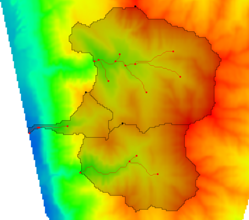
The SRP UGrids from Watersheds tool derives a set of UGrids from watersheds, their stream locations, and an elevation raster as shown in the images below.
This tool converts the watershed boundaries and streams to UGrids and assigns elevations to the UGrids as follows:
- First, the tool gets the watershed polygons in the watershed shapefile.
- Next, the tool gets the stream polylines in the stream shapefile.
- The tool then assigns a watershed polygon ID to each stream.
- The vertices on the watershed polygons are redistributed according to the user-specified Watershed polygon redistribution distance.
- The vertices on the stream polylines are redistributed according to the user-specified Stream redistribution distance.
- For each watershed polygon, a mesh is built using the redistributed watershed polygon and the redistributed stream polylines and some standard mesh creation parameters (a mesh bias of 0.3 is used).
- The elevations are interpolated to each new mesh from the user-specified elevation raster.
Input Parameters
- Input raster – Select the input elevation raster used to interpolate elevations to the mesh(es).
- Watershed boundaries – Select a coverage containing one or more polygons containing watershed boundaries. This tool can just use the watershed boundaries generated from the SRP Watersheds from Raster Tool.
- Stream lines – Select a coverage containing stream lines in the watersheds. This tool can just use the streams generated from the SRP Watersheds from Raster Tool.
- Watershed polygon redistribution distance – The distance, in model units, for redistributing vertices along the watershed polygon boundaries.
- Stream redistribution distance – The distance, in model units, for redistributing vertices along the stream polylines.
Output Parameters
- Base name of the output grids – The base name of the output grids. The final grid names will append an index (1, 2, 3, ...) onto this name for the final grid name.
Current Location in toolbox
Unstructured Grids/SRP UGrids from Watersheds

