The 2D Scatter Point module is used to interpolate from groups of 2D scattered data to other objects (meshes, grids, TINs). Several interpolation schemes are supported, including Clough-Tocher, inverse distance weighted, and kriging.
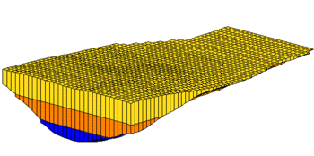
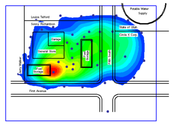
Interpolation is useful for setting up input data for analysis codes and for site characterization. The two figures below show examples of using interpolation.
 Interpolation of Modflow layer elevations to a 3D grid |
 Sample interpolation for site characterization |
A number of tools are included for creating and manipulating 2D scatter point sets. In general, 2D scatter sets are imported using the File Import Wizard. 2D scatter sets can also be created from other objects in GMS such as GIS objects, feature objects, meshes, grids, TINs, etc.
Multiple 2D scatters sets can be in the module. Existing scatter sets can be duplicated or merged together.
Besides interpolating 2D scatter sets to other data, the module can also be used to create objects (meshes, grids, TINs) from the scatter data.
The module contains its own display options which include contour displays. Also, each scatter point has an active/inactive status. A scatter point with an inactive status can be displayed, but the dataset value at the point is ignored when interpolation takes place.
The 2D Scatter Point module also allows exporting scatter sets by right-clicking on the scatter set and selecting the Export command. Options for export include: Text Tab Deliminated 2D Scatter Point Files (*.txt), Text GMS 2D Scatter Point Files (*.xy), and Shapefiles (*.shp).


