AHGW:Flow Direction Editor: Difference between revisions
From XMS Wiki
Jump to navigationJump to search
(Created page with "thumb|300px|right|Example of flow direction arrows. Raster datasets in the Arc Hydro Groundwater Data Model can be use...") |
No edit summary |
||
| Line 4: | Line 4: | ||
{{Navbox AHGW}} | {{Navbox AHGW}} | ||
[[Category:AHGW | [[Category:AHGW Groundwater Analyst]] | ||
Revision as of 20:39, 22 August 2019
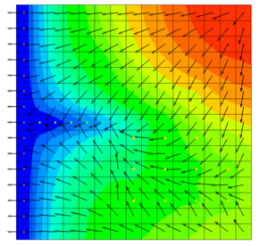
Raster datasets in the Arc Hydro Groundwater Data Model can be used to show the direction of flow in an aquifer. This tool will create a new graphics layer covering the extent of the raster, showing flow direction arrows at a specified interval.

