WMS:Quick Tour -HSPF: Difference between revisions
From XMS Wiki
Jump to navigationJump to search
No edit summary |
No edit summary |
||
| (3 intermediate revisions by one other user not shown) | |||
| Line 5: | Line 5: | ||
[[WMS:Quick Tour -National | [[WMS:Quick Tour -National Streamflow Statistics (NSS)| '''< Previous''']] | [[WMS:Quick Tour - HSPF | ''' Next >''']] | ||
{{WMSQuick}} | |||
[[Category:WMS Quick Tour|HSPF]] | |||
[[Category:HSPF]] | |||
Latest revision as of 22:26, 27 January 2020
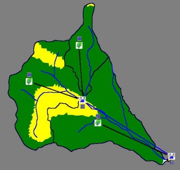
There is a comprehensive interface to HSPF, the EPA's hydrologic model of choice for development of TMDLs. As part of the interface WMS automates segmentation of basins from polygons of land use and/or soil.

