WMS:Quick Tour - DEMs: Difference between revisions
From XMS Wiki
Jump to navigationJump to search
No edit summary |
No edit summary |
||
| (One intermediate revision by the same user not shown) | |||
| Line 1: | Line 1: | ||
[[Image:wmsquicktour.jpg]] | [[Image:wmsquicktour.jpg]] | ||
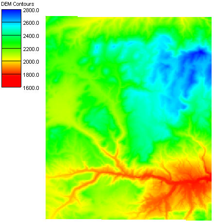
Digital elevation models can be used to quickly delineate watershed boundaries. Gridded elevation datasets can be downloaded from the [ | Digital elevation models can be used to quickly delineate watershed boundaries. Gridded elevation datasets can be downloaded from the [https://www.usgs.gov/tools/national-map-viewer National Elevation Dataset (NED)]. This elevation data is available at a resolution of 30-meters for the entire U.S. and some 90-meter world-wide data is also available. | ||
[[Image:WMS DEMexampleQuick.jpg]] | [[Image:WMS DEMexampleQuick.jpg]] | ||
| Line 13: | Line 13: | ||
[[Category:WMS Quick Tour|DEM]] | [[Category:WMS Quick Tour|DEM]] | ||
[[Category:DEM]] | [[Category:DEM]] | ||
[[Category: External Links]] | |||
Latest revision as of 21:07, 3 February 2023
Digital elevation models can be used to quickly delineate watershed boundaries. Gridded elevation datasets can be downloaded from the National Elevation Dataset (NED). This elevation data is available at a resolution of 30-meters for the entire U.S. and some 90-meter world-wide data is also available.


