GMS:What Is GMS: Difference between revisions
No edit summary |
|||
| Line 16: | Line 16: | ||
{{Navbox GMS}} | {{Navbox GMS}} | ||
[[Category:GMS General Information]] | [[Category:GMS General Information]] | ||
[[Category:External Links]] | |||
Latest revision as of 17:41, 28 October 2014
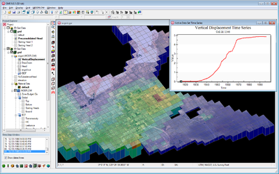
The Groundwater Modeling System (GMS) is a comprehensive graphical user environment for performing groundwater simulations. The entire GMS system consists of a graphical user interface (the GMS program) and a number of analysis codes (MODFLOW, MT3DMS, etc.). The GMS interface is developed by Aquaveo, LLC in Provo, Utah.
GMS was designed as a comprehensive modeling environment. Several types of models are supported and facilities are provided to share information between different models and data types. Tools are provided for site characterization, model conceptualization, mesh and grid generation, geostatistics, and post-processing.
Modules
The interface for GMS is divided into twelve modules. A module is provided for each of the basic data types supported by GMS. As you switch from one module to another module, the Dynamic Tool Palette and the Menus change. This allows you to focus only on the tools and commands related to the data type you wish to use in the modeling process. The following modules are supported in GMS:
Numerical Models
Numerical models are programs that are separate from GMS that are used to run an analysis on a simulation. The simulation can be built in GMS, and then run through the numerical model program. GMS can then read in and display the results of the analysis.
The following numerical models are currently supported in GMS.
| Model Name | GMS Module |
|---|---|
| Map Module | |
| 2D Mesh | |
| 3D Mesh | |
| Boreholes |
Source code for some models is available upon request. Contact technical support to request source code.
GMS – Groundwater Modeling System | ||
|---|---|---|
| Modules: | 2D Grid • 2D Mesh • 2D Scatter Point • 3D Grid • 3D Mesh • 3D Scatter Point • Boreholes • GIS • Map • Solid • TINs • UGrids | |
| Models: | FEFLOW • FEMWATER • HydroGeoSphere • MODAEM • MODFLOW • MODPATH • mod-PATH3DU • MT3DMS • MT3D-USGS • PEST • PHT3D • RT3D • SEAM3D • SEAWAT • SEEP2D • T-PROGS • ZONEBUDGET | |
| Aquaveo | ||


