GMS:2D Scatter Point Module: Difference between revisions

From XMS Wiki
Jump to navigationJump to search
No edit summary
No edit summary
Line 5: Line 5:


{|
{|
|-valign="top"|
|-
|[[Image:Sample_LayInterp.png|thumb|350px|Interpolation of Modflow layer elevations to a 3D grid]]
|valign="top"|[[Image:Sample_LayInterp.png|thumb|350px|Interpolation of Modflow layer elevations to a 3D grid]]
|[[Image:samp_2dscat.png|thumb|350px|Sample interpolation for site characterization]]
|[[Image:samp_2dscat.png|thumb|350px|Sample interpolation for site characterization]]
|}
|}

Revision as of 16:40, 7 June 2016

2D Scatter Point Module
Samp 2dscat.png
2D Scatter Point
Creating and Editing 2D Scatter Point Sets
Interpolating with 2D Scatter Points
Converting 2D Scatter Points to Other Types of Data
More
2D Interpolation Options
2D Scatter Point Display Options
2D Scatter Point Tool Palette
Active/Inactive Points
Clough-Tocher
Inverse Distance Weighted
2D Scatter Point Commands
Interpolation Commands

The 2D Scatter Point module is used to interpolate from groups of 2D scattered data to other objects (meshes, grids, TINs). Several interpolation schemes are supported, including kriging.

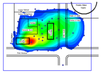
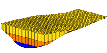
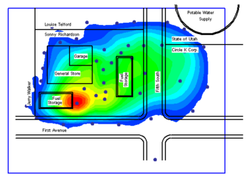
Interpolation is useful for setting up input data for analysis codes and for site characterization. The two figures below show examples of using interpolation.

Interpolation of Modflow layer elevations to a 3D grid
Sample interpolation for site characterization