GMS:GMS: Difference between revisions
From XMS Wiki
Jump to navigationJump to search
No edit summary |
No edit summary |
||
| Line 22: | Line 22: | ||
! <h2 style="margin:0; background:#cef2e0; font-size:120%; font-weight:bold; border:1px solid #a3bfb1; text-align:left; color:#000; padding:0.2em 0.4em;">What's New</h2> | ! <h2 style="margin:0; background:#cef2e0; font-size:120%; font-weight:bold; border:1px solid #a3bfb1; text-align:left; color:#000; padding:0.2em 0.4em;">What's New</h2> | ||
|- | |- | ||
|style="color:#000;"| | |style="color:#000;"| | ||
*[[GMS:What's New in GMS 10.4|What's New in GMS 10.4]] (coming soon) | |||
*[[GMS:What's New in GMS 10.3|What's New in GMS 10.3]] | *[[GMS:What's New in GMS 10.3|What's New in GMS 10.3]] | ||
*[[GMS:Bugfixes GMS|Bugfixes]] | *[[GMS:Bugfixes GMS|Bugfixes]] | ||
Revision as of 17:42, 31 October 2018
|
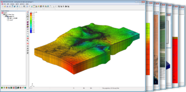
GMS (Groundwater Modeling System)
|
Speed & Simplicity in 3D
|
|
|
The information in this wiki applies to the current version of GMS. For older versions, refer to the help shipped with the program or the older user manuals.
GMS – Groundwater Modeling System | ||
|---|---|---|
| Modules: | 2D Grid • 2D Mesh • 2D Scatter Point • 3D Grid • 3D Mesh • 3D Scatter Point • Boreholes • GIS • Map • Solid • TINs • UGrids | |
| Models: | FEFLOW • FEMWATER • HydroGeoSphere • MODAEM • MODFLOW • MODPATH • mod-PATH3DU • MT3DMS • MT3D-USGS • PEST • PHT3D • RT3D • SEAM3D • SEAWAT • SEEP2D • T-PROGS • ZONEBUDGET | |
| Aquaveo | ||
