GMS:FEMWATER Conceptual Model Approach: Difference between revisions
From XMS Wiki
Jump to navigationJump to search
No edit summary |
|||
| Line 12: | Line 12: | ||
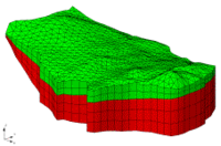
A FEMWATER conceptual model is used to build a numerical model using a two step process. In the first step, a 3D mesh is created. This can be done by using the feature objects in conjunction [[#Building the 3D Mesh from the FEMWATER Conceptual Model|with a set of TINs to build a 3D Mesh]] or a solid can be converted to a layered 3D Mesh using the [[GMS:Solids to Layered Mesh|'''''Solids -> Layered Mesh''''']] command. In the second step, the boundary conditions and recharge values assigned to the feature objects are automatically assigned to the appropriate nodes and element faces of the 3D mesh using the '''''Feature Objects | Map -> FEMWATER''''' command. | A FEMWATER conceptual model is used to build a numerical model using a two step process. In the first step, a 3D mesh is created. This can be done by using the feature objects in conjunction [[#Building the 3D Mesh from the FEMWATER Conceptual Model|with a set of TINs to build a 3D Mesh]] or a solid can be converted to a layered 3D Mesh using the [[GMS:Solids to Layered Mesh|'''''Solids -> Layered Mesh''''']] command. In the second step, the boundary conditions and recharge values assigned to the feature objects are automatically assigned to the appropriate nodes and element faces of the 3D mesh using the '''''Feature Objects | Map -> FEMWATER''''' command. | ||
To create a FEMWATER conceptual model right click on the Map Data folder in the [[GMS:The GMS Screen|Project Explorer]] and select the '''''New Conceptual Model''''' command. In the Conceptual Model Properties dialog change the model type to FEMWATER in the pull-down list. In the dialog the simulation options of flow and transport can also be toggled on or off. Next create a [[GMS:Coverages|coverage]] by right clicking on the FEMWATER conceptual model in the data tree and selecting | To create a FEMWATER conceptual model right click on the Map Data folder in the [[GMS:The GMS Screen|Project Explorer]] and select the '''''New Conceptual Model''''' command. In the Conceptual Model Properties dialog change the model type to FEMWATER in the pull-down list. In the dialog the simulation options of flow and transport can also be toggled on or off. Next create a [[GMS:Coverages|coverage]] by right clicking on the FEMWATER conceptual model in the data tree and selecting '''New Coverage'''. The coverage attributes can then be setup in the ''Coverage Setup'' dialog. | ||
A FEMWATER coverage can contain points, arcs, and polygons. The points are used to define wells, the arcs are used to define boundary conditions, and the polygons are used to define recharge zones. In most cases, a single coverage is sufficient. However, multiple FEMWATER coverages can be used if desired. | A FEMWATER coverage can contain points, arcs, and polygons. The points are used to define wells, the arcs are used to define boundary conditions, and the polygons are used to define recharge zones. In most cases, a single coverage is sufficient. However, multiple FEMWATER coverages can be used if desired. | ||
