GMS:Interpolating with 3D Scatter Points: Difference between revisions
No edit summary |
No edit summary |
||
| Line 4: | Line 4: | ||
The basic approach to performing an interpolation is to select an appropriate interpolation scheme and interpolation parameters, and then interpolate to the desired object using one of the [[GMS:Interpolation Commands|3D Interpolation Commands]]. | The basic approach to performing an interpolation is to select an appropriate interpolation scheme and interpolation parameters, and then interpolate to the desired object using one of the [[GMS:Interpolation Commands|3D Interpolation Commands]]. | ||
The interpolation options are selected using the [[GMS:3D Interpolation Options|Interpolation Options dialog]] accessed through the '''''Interp. Options''''' command in the ''Interpolation'' menu. Once a set of options is selected, those options are used for all subsequent interpolation commands. | The interpolation options are selected using the [[GMS:3D Interpolation Options|Interpolation Options dialog]] accessed through the '''''Interp. Options''''' command in the ''Interpolation'' menu. Once a set of options is selected, those options are used for all subsequent interpolation commands. Interpolation options are saved in the project file. | ||
{{Navbox GMS}} | {{Navbox GMS}} | ||
[[Category:3D Scatter Point]] | [[Category:3D Scatter Point]] | ||
Revision as of 21:33, 18 December 2012
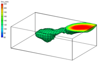
Scatter point sets are used for interpolation to other data types such as TINs, grids, and meshes. A 3D grid can be created which will just enclose the scatter points by using the Bounding Grid command in the Scatter Points menu. Interpolation is useful for such tasks as contouring or setting up input data to a model. Since no interpolation scheme is superior in all cases, several interpolation techniques are provided in GMS.
The basic approach to performing an interpolation is to select an appropriate interpolation scheme and interpolation parameters, and then interpolate to the desired object using one of the 3D Interpolation Commands.
The interpolation options are selected using the Interpolation Options dialog accessed through the Interp. Options command in the Interpolation menu. Once a set of options is selected, those options are used for all subsequent interpolation commands. Interpolation options are saved in the project file.
GMS – Groundwater Modeling System | ||
|---|---|---|
| Modules: | 2D Grid • 2D Mesh • 2D Scatter Point • 3D Grid • 3D Mesh • 3D Scatter Point • Boreholes • GIS • Map • Solid • TINs • UGrids | |
| Models: | FEFLOW • FEMWATER • HydroGeoSphere • MODAEM • MODFLOW • MODPATH • mod-PATH3DU • MT3DMS • MT3D-USGS • PEST • PHT3D • RT3D • SEAM3D • SEAWAT • SEEP2D • T-PROGS • ZONEBUDGET | |
| Aquaveo | ||
