WMS:Quick Tour - Flow Accumulation
From XMS Wiki
Jump to navigationJump to search
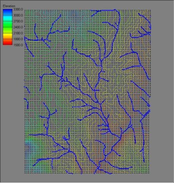
In addition to defining the flow direction from each DEM cell, the TOPAZ program determines the flow accumulation for each DEM cell. The flow accumulation is an integer number and represents the number of upstream DEM cells whose flow paths "pass through" the given DEM cell. In the figure below a display values has been set so that each DEM cell whose flow accumulation is greater than or equal to 200 is shown in blue. In reality it approximates where "channels" are on the DEM and is an essential part of establishing watershed boundaries.


