GMS:TIN Module
From XMS Wiki
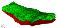
TIN stands for Triangulated Irregular Network. TINs are used for surface modeling. TINs are formed by connecting a set of XYZ points with edges to form a network of triangles. TINs can be used to represent the surface of a geologic unit or the surface defined by a mathematical function.
Several TINs can be modeled at once in GMS. One of the TINs is designated as the "active" TIN. The selection and editing tools apply to the active TIN only.
| GMS – Groundwater Modeling System | ||
|---|---|---|
| Modules: | 2D Grid • 2D Mesh • 2D Scatter Point • 3D Grid • 3D Mesh • 3D Scatter Point • Boreholes • GIS • Map • Solid • TINs • UGrids | |
| Models: | FEFLOW • FEMWATER • HydroGeoSphere • MODAEM • MODFLOW • MODPATH • mod-PATH3DU • MT3DMS • MT3D-USGS • PEST • PHT3D • RT3D • SEAM3D • SEAWAT • SEEP2D • T-PROGS • ZONEBUDGET | |
| Aquaveo | ||
This article is a [stub]. You can help xmswiki by expanding it.
Retrieved from "https://www.xmswiki.com/index.php?title=GMS:TIN_Module&oldid=81450"
Hidden category:
