AHGW:What's New in AHGW 2.1.0
The more significant new features in Arc Hydro Groundwater 2.1.0 are listed below.
Arc GIS 9.3 Required
The new Arc Hydro Groundwater toolkit now requires Arc GIS version 9.3. Previous version of Arc Hydro Groundwater supported both Arc GIS 9.2 and 9.3.
Subsurface Analyst
Subsurface Analyst includes new tools for working with non-vertical boreline data, well detail features for XS2D plots, and converting GeoSection features to points.
Non-vertical borelines
Two new tools have been added for working with non-vertical borelines. The Desurvey Borelog tool reads a table of bore log data, and desurveys the data into a set of XYZ coordinates in another table. The bore log contains dip and azimuth readings, and relates back to Well features. Once the desurvey table has been created, the Create Non-Vertical Borelines tool can be used to create the new boreline features. You can run the geoprocessing tools from Arc Map, Arc Catalog, etc., but as the non-vertical borelines are 3D features, they are best visualized in Arc Scene, which requires a 3D Analyst extension.
GeoSection to Points
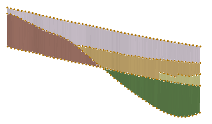
This new geoprocessing tool creates new BorePoint features along the top and bottom of GeoSection features. A sampling distance is specified to determine how densely the new points are created. The results of this tool could then be used to interpolate raster surfaces of the subsurface data.
MODFLOW Analyst
A small update was made to the MODFLOW 2000 executable shipped with Arc Hydro Groundwater.
Groundwater Analyst
Minor fixes and updates were added to the HGU Color Manager.
See also


