Map to WASH123D BCs
From XMS Wiki
Revision as of 17:13, 17 November 2022 by Mkennard (talk | contribs) (Created page with "===Map to WASH123D BCs=== The ''Map to WASH123D BCs'' tool maps a FEMWATER coverage to a UGrid and writes a FEMWATER 3bc file. With some further processing, this file can be...")
Map to WASH123D BCs
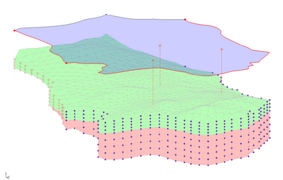
The Map to WASH123D BCs tool maps a FEMWATER coverage to a UGrid and writes a FEMWATER 3bc file. With some further processing, this file can be used in a WASH123D model. The tool only works with UGrids, so it will likely be necessary to convert the 3D mesh used by WASH to a UGrid. If GMS is used to convert a 3D mesh to a UGrid, then the tool will output the correct 3D mesh cell, node, and face numbers even though the tool operates on a UGrid. UGrids that are not created from a 3D mesh will likely not have the proper numbering.
Input Parameters
- Input FEMWATER coverage – The FEMWATER coverage.
- Input UGrid – The UGrid that the coverage will be mapped to.
- Input material dataset – A dataset representing the material IDs of the cells of the UGrid (currently this is the only way for the tool to access material data).
Output Parameters
- Output 3bc file – File name of the 3bc file.
Current Location in Toolbox
WASH123D | Map to WASH123D BCs
GMS – Groundwater Modeling System | ||
|---|---|---|
| Modules: | 2D Grid • 2D Mesh • 2D Scatter Point • 3D Grid • 3D Mesh • 3D Scatter Point • Boreholes • GIS • Map • Solid • TINs • UGrids | |
| Models: | FEFLOW • FEMWATER • HydroGeoSphere • MODAEM • MODFLOW • MODPATH • mod-PATH3DU • MT3DMS • MT3D-USGS • PEST • PHT3D • RT3D • SEAM3D • SEAWAT • SEEP2D • T-PROGS • ZONEBUDGET | |
| Aquaveo | ||
