Map to WASH123D BCs
From XMS Wiki
This is the approved revision of this page, as well as being the most recent.
Jump to navigationJump to search
| This contains information about future features. |
Map to WASH123D BCs
This tool is for internal use by the US Army Corp of Engineers (USACE). Questions about using this tool will be forwarded to the USACE.
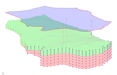
The Map to WASH123D BCs tool maps a FEMWATER coverage to a UGrid and writes a FEMWATER 3bc file. With some further processing, this file can be used in a WASH123D model. The tool only works with UGrids, so it will likely be necessary to convert the 3D mesh used by WASH to a UGrid. If GMS is used to convert a 3D mesh to a UGrid, then the tool will output the correct 3D mesh cell, node, and face numbers even though the tool operates on a UGrid. UGrids that are not created from a 3D mesh will likely not have the proper numbering.
Input Parameters
- Input FEMWATER coverage – The FEMWATER coverage.
- Input UGrid – The UGrid that the coverage will be mapped to.
- Input material dataset – A dataset representing the material IDs of the cells of the UGrid (currently this is the only way for the tool to access material data).
Output Parameters
- Output 3bc file – File name of the 3bc file.
Current Location in Toolbox
WASH123D | Map to WASH123D BCs
GMS – Groundwater Modeling System | ||
|---|---|---|
| Modules: | 2D Grid • 2D Mesh • 2D Scatter Point • 3D Grid • 3D Mesh • 3D Scatter Point • Boreholes • GIS • Map • Solid • TINs • UGrids | |
| Models: | FEFLOW • FEMWATER • HydroGeoSphere • MODAEM • MODFLOW • MODPATH • mod-PATH3DU • MT3DMS • MT3D-USGS • PEST • PHT3D • RT3D • SEAM3D • SEAWAT • SEEP2D • T-PROGS • ZONEBUDGET | |
| Aquaveo | ||
