GMS:Creating a TIN
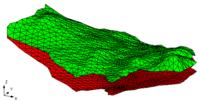
In order to create a TIN in GMS you must have a set of TIN vertices. Then the TIN is created by triangulating the vertices (connecting the vertices with lines to form triangles). The triangulation algorithm assumes that each of the vertices being triangulated is unique in the xy plane, i.e., no two points have the same xy location. Duplicate points can be removed by selecting Find Duplicates from the TINs menu.
TINs can be created 3 different ways in GMS: manually entering the vertex locations and triangulating, converting a different GMS data type to a TIN, and copying a currently existing TIN.
Manually Creating a TIN
A TIN can be created manually from the following steps:
- Right-click in the empty space of the Project Explorer and select the New -> TIN command.
- Select the Create Vertices tool from the TIN Tool Palette.
- Create the vertices by clicking inside the Graphics Window at the xy coordinates where you want the vertex located. (To change the vertex location see: Editing a TIN)
- Select the Triangulate command from the TINs menu.
Creating a TIN from GMS Data
2D meshes, 2D grids, and 2D scatter points can all be converted to a TIN. This is accomplished by using the following commands:
- Mesh to TIN
- Grid to TIN
- Scatter Points to TIN
- Contacts to TIN
- Watertable to TIN
- Add Contacts to TIN - This command is used to enter a point from a contact into the active TIN . The contact(s) are first selected and the command is then chosen from the Borehole menu. Typically all contacts which should be part of a TIN are selected before generating the TIN, but sometimes one is inadvertently left out, or more boreholes are added later.
Copying a Current TIN
To make a copy of a TIN that currently exists in GMS follow these steps:
- Select the TIN you wish to copy using the Select TINs tool.
- Select the Duplicate TIN command from the TINs menu. A dialog appears prompting for the Z offset of the new TIN. The Z offset is used to displace the TIN above or below the TIN being duplicated.
| GMS – Groundwater Modeling System | ||
|---|---|---|
| Modules: | 2D Grid • 2D Mesh • 2D Scatter Point • 3D Grid • 3D Mesh • 3D Scatter Point • Boreholes • GIS • Map • Solid • TINs • UGrids | |
| Models: | FEFLOW • FEMWATER • HydroGeoSphere • MODAEM • MODFLOW • MODPATH • mod-PATH3DU • MT3DMS • MT3D-USGS • PEST • PHT3D • RT3D • SEAM3D • SEAWAT • SEEP2D • T-PROGS • ZONEBUDGET | |
| Aquaveo | ||
