Category:Noindexed pages
From XMS Wiki
Jump to navigationJump to search
Pages tagged with NOINDEX.
Pages in category "Noindexed pages"
The following 200 pages are in this category, out of 585 total.
(previous page) (next page)G
- GMS:GMS User Manual 9.0
- GMS:GMS User Manual 9.1
- GMS:GMS User Manual 9.2
- GMS:GMS User Manual Vol 1
- GMS:GMS User Manual Vol 2
- GMS:GMS User Manual Vol 3
- GMS:GMS User Manual Vol 4
- Template:Gravity Waves Courant Number
- Template:Gravity Waves Time Step
- Template:GSSHA 2D UGrid Tool
- Template:GSSHA Define and Smooth Streams Workflow
H
I
- Template:Import Curvilinear Grid
- Template:Import Horizontal Grid as 2D Mesh Tool
- Template:Import Horizontal Grid Tool
- Template:Import Spectra
- SMS:Import Spectra Workflow
- Template:Import SSURGO shapefile data
- Template:Import UGrid Points
- SMS:Importing Dredge Tracks from ASCII Files
- SMS:Interpolate Cross Sections
- Template:Interpolate Priority Rasters
- Template:Interpolate to UGrid
- Template:Isobasins
J
- User:Jcreer
- User:Jcreer/Aquaveo License Service
- User:Jcreer/Archived Images
- User:Jcreer/Choose Color Ramp
- User:Jcreer/Clean Options
- User:Jcreer/CMS-Wave 13.2
- User:Jcreer/CMS-Wave Project Workflow 13.2
- User:Jcreer/Data Sources Table
- User:Jcreer/Dataset Calculator Tool
- User:Jcreer/Direction Conventions and Conversions
- User:Jcreer/Dynamic Model Interface Schema
- User:Jcreer/GMS 99.99 Changes
- User:Jcreer/GMS:MODFLOW Model Wrapper
- User:Jcreer/GMS:MP3DU 10.4
- User:Jcreer/GMS:Save to MODFLOW 6
- User:Jcreer/GMS:TVM Package
- User:Jcreer/GMS:UGrid Interpolation 10.4
- User:Jcreer/Known Issues
- User:Jcreer/MDOFLOW 6 New Packages
- User:Jcreer/MDT Package
- User:Jcreer/MODFLOW 6
- User:Jcreer/MODFLOW 6 Changes for GMS 10.6
- User:Jcreer/New Arc Functions in SMS 13.2
- User:Jcreer/SMS 13.1 Changes
- User:Jcreer/SMS 13.2 Changes
- User:Jcreer/SMS 13.3 Changes
- User:Jcreer/SMS 13.4 Changes
- User:Jcreer/SMS Bridge Scour 13.1
- User:Jcreer/SMS Display Themes Workflow
- User:Jcreer/SMS Model Coverage File
- User:Jcreer/SMS: Sediment Transport Parameters 13.1
- User:Jcreer/SMS:1D Module
- User:Jcreer/SMS:3D Bridge
- User:Jcreer/SMS:3D Structures
- User:Jcreer/SMS:ADCIRC Coverages 13.1
- User:Jcreer/SMS:ADCIRC Coverages in SMS 13.0
- User:Jcreer/SMS:ADCIRC Graphical Interface 13.1
- User:Jcreer/SMS:ADCIRC Graphical Interface in SMS 13.0
- User:Jcreer/SMS:ADCIRC Menu in SMS 13.0
- User:Jcreer/SMS:ADCIRC Model Control 13.1
- User:Jcreer/SMS:ADCIRC Model Control in SMS 13.0
- User:Jcreer/SMS:ADCIRC Tidal Constituents
- User:Jcreer/SMS:AdH Interface
- User:Jcreer/SMS:Bridge Scour
- User:Jcreer/SMS:Bridge Scour Workflow
- User:Jcreer/SMS:Bug Trace
- User:Jcreer/SMS:CMS-Flow Coverages 13.1
- User:Jcreer/SMS:CMS-Flow Model Control 13.1
- User:Jcreer/SMS:Contour Label Options
- User:Jcreer/SMS:Corrupt Project Data
- User:Jcreer/SMS:Datasets to Rasters
- User:Jcreer/SMS:DMI Check Box Elements
- User:Jcreer/SMS:DMI Combo Box Elements
- User:Jcreer/SMS:DMI Control Curve Elements
- User:Jcreer/SMS:DMI File Definitions Elements
- User:Jcreer/SMS:DMI Table Elements
- User:Jcreer/SMS:DMI Text Elements
- User:Jcreer/SMS:DMI Widgets and Dialogs Elements
- User:Jcreer/SMS:EWN
- User:Jcreer/SMS:EWN Features Workflow
- User:Jcreer/SMS:Extract Features Tool
- User:Jcreer/SMS:Feature Stamping Dialogs
- User:Jcreer/SMS:FLO-2D
- User:Jcreer/SMS:GIS Conversion and Editing
- User:Jcreer/SMS:GIS Module Display Options 13.2
- User:Jcreer/SMS:GSSHA
- User:Jcreer/SMS:GSSHA Coverages
- User:Jcreer/SMS:GSSHA Mapping Tables
- User:Jcreer/SMS:GSSHA Model Control
- User:Jcreer/SMS:Preferences 13.1
- User:Jcreer/SMS:Select Intersecting Objects
- User:Jcreer/SMS:SRH-2D Advanced Simulation
- User:Jcreer/SMS:SRH-2D Boundary Conditions 13.1
- User:Jcreer/SMS:SRH-2D Changes
- User:Jcreer/SMS:SRH-2D Channel Calculator
- User:Jcreer/SMS:SRH-2D Coverages 13.1
- User:Jcreer/SMS:SRH-2D Floodway Tools
- User:Jcreer/SMS:SRH-2D Material Properties 13.1
- User:Jcreer/SMS:SRH-2D Menus 13.1
- User:Jcreer/SMS:SRH-2D Model Control 13.1
- User:Jcreer/SMS:SRH-2D Simulations 13.1
- User:Jcreer/SMS:SRH-2D Solution Data
- User:Jcreer/SMS:SRH-2D Summary Report
- User:Jcreer/SMS:STWAVE Coverages in SMS 13.0
- User:Jcreer/SMS:STWAVE Graphical Interface in SMS 13.0
- User:Jcreer/SMS:STWAVE Menu in SMS 13.0
- User:Jcreer/SMS:STWAVE Model Control in SMS 13.0
- User:Jcreer/SMS:TABS Troubleshooting for SMS 13.1
- User:Jcreer/SMS:Toolbox
- User:Jcreer/SMS:UGrid Clipping Workflow
- User:Jcreer/SMS:UGrid Display Options
- User:Jcreer/SNS:DMI Exporting/Importing Elements
- User:Jcreer/SRH-2D BC Data Lines Workflow
- User:Jcreer/SRH-2D Error Messages Tables
- User:Jcreer/SRH-2D Pressure Flow Bridge with 3D Bridges Workflow
- User:Jcreer/SWB
- User:Jcreer/SWB Model Control
- User:Jcreer/Toolbox 2D Mesh Tools
- User:Jcreer/Toolbox Coverages Tools
- User:Jcreer/Toolbox Rasters Tools
- User:Jcreer/Toolbox Unstructured Grids Tools
- User:Jcreer/Toolbox updates
- User:Jcreer/TUFLOW FV for SMS 13.2
- User:Jcreer/Tutorial Course Map
- User:Jcreer/WMS 99.99 TR-20 Changes
- User:Jmonson
- User:Jmonson/AHGW
- User:Jmonson/Floodway delineation
- User:Jmonson/GSSHA
- User:Jmonson/MODFLOW 6 Packages
- User:Jmonson/News
- User:Jmonson/WMS:1D-HYD Cross Section Coverage Type
L
M
- SMS:M2D
- Template:Mannings N from Land Use Raster
- Template:Map Activity
- Template:Map Activity to UGrid
- Template:Map Solids
- Template:Map to WASH123D BCs
- User talk:Mburton
- User:Mburton/13.3 Coverages Tools
- User:Mburton/13.3 Rasters Tools
- User:Mburton/13.3 UGrids Tools
- User:Mburton/HydroGeoSphere Arc Properties Dialog
- User:Mburton/HydroGeoSphere Coverages
- User:Mburton/HydroGeoSphere Materials Dialog
- User:Mburton/HydroGeoSphere Point Properties Dialog
- User:Mburton/HydroGeoSphere Polygon Properties Dialog
- User:Mburton/HydroGeoSphere Simulation Control
- User:Mburton/SMS 13.3 Dataset Tools
- Template:Mean Filter
- Template:Merge 2D Meshes
- Template:Merge 2D UGrids
- Template:Merge Datasets
- Template:Merge Elevation Rasters
- Template:Merge UGrids
- Template:Mesh Backup Tool
- Template:Mesh Reload Tool
- User:Mkennard/GSSHA:Remove Adverse Slopes Tool
- User:Mkennard/Remove Adverse Slopes
- WMS:Model Documentation
- SMS:Multiple Elevation Sources Workflow
P
- SMS:Patches
- SMS:PBL
- Template:Point Dataset from Cell Dataset
- Template:Point Spacing
- Template:Polygon from Raster Bounds
- Template:Polygon from Raster Nodata
- Template:Polygons from Arcs
- Template:Polygons from Index Raster
- Template:Polygons from UGrid Boundary
- Template:Primitive Weighting
- GMS:Project Template Files
Media in category "Noindexed pages"
The following 13 files are in this category, out of 13 total.
- BridgeScourCoverageProperties.png 584 × 752; 33 KB
- BridgeScourDefaultOpts.png 359 × 296; 14 KB
- BridgeScourScenarioCritiVel.png 362 × 203; 9 KB
- BridgeScourSoilGeneration.png 353 × 230; 7 KB
- EditBridgeScourScenario.png 354 × 282; 12 KB
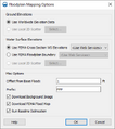
- FloodplainMapping Options.png 388 × 437; 21 KB
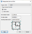
- Lidar to UGrid.png 348 × 368; 14 KB
- LidarDisplayOptions1.png 687 × 416; 19 KB
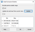
- LidarExclusionExtents.png 315 × 287; 9 KB
- LidarToRaster.png 314 × 244; 10 KB
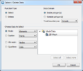
- SMS Select Delete Data.png 476 × 407; 32 KB
- SRH-2D Summary Report.png 361 × 596; 17 KB
- SWB ModelControl.png 533 × 935; 54 KB


