WMS:Quick Tour -HEC-1 - Area Between Contours: Difference between revisions
From XMS Wiki
Jump to navigationJump to search
No edit summary |
No edit summary |
||
| (5 intermediate revisions by the same user not shown) | |||
| Line 1: | Line 1: | ||
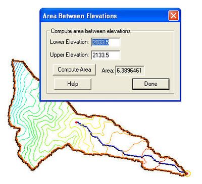
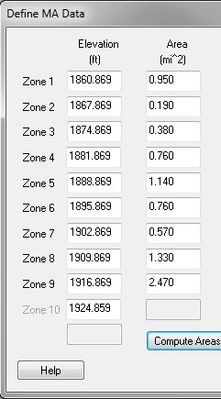
WMS includes a general tool to compute the area between specified elevations (contours). This information is particularly important for snowmelt analysis such as can be done using HEC-1. | WMS includes a general tool to compute the area between specified elevations (contours). This information is particularly important for snowmelt analysis such as can be done using HEC-1. | ||
<gallery widths="400px" heights="400px"> | |||
Image:AreaBetweenElevationsQuick.jpg | |||
Image:DefineMAdata.jpg | |||
</gallery> | |||
[[WMS:Quick Tour -HEC-1 - Time Area Curves | '''< Previous''']] | [[WMS:Quick Tour -TR-20 | ''' Next >''']] | [[WMS:Quick Tour -HEC-1 - Time Area Curves | '''< Previous''']] | [[WMS:Quick Tour -TR-20 | ''' Next >''']] | ||
{{WMSQuick}} | |||
[[Category:WMS Quick Tour|H]] | [[Category:WMS Quick Tour|H]] | ||
[[Category:HEC-1]] | |||
[[Category:Gallery]] | |||
Latest revision as of 17:55, 10 October 2017
WMS includes a general tool to compute the area between specified elevations (contours). This information is particularly important for snowmelt analysis such as can be done using HEC-1.


