Category:ADCIRC
From XMS Wiki
Jump to navigationJump to search
Articles related to the ADCIRC model in SMS.
Subcategories
This category has the following 4 subcategories, out of 4 total.
Pages in category "ADCIRC"
The following 36 pages are in this category, out of 36 total.
A
G
M
Media in category "ADCIRC"
The following 84 files are in this category, out of 84 total.
- ADCIRC AddWeir.png 279 × 159; 12 KB
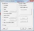
- ADCIRC Arc BC.jpg 456 × 405; 30 KB
- ADCIRC Binary Wind.jpg 304 × 222; 14 KB
- ADCIRC Fleet Wind File.jpg 444 × 365; 29 KB
- ADCIRC Island BC.jpg 636 × 360; 33 KB
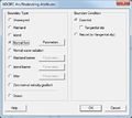
- ADCIRC LinearBC.png 516 × 448; 11 KB
- ADCIRC Mainland BC.jpg 636 × 360; 30 KB
- ADCIRC MC Files.jpg 732 × 611; 168 KB
- ADCIRC MC General.jpg 732 × 611; 110 KB
- ADCIRC MC Sediment.jpg 732 × 611; 61 KB
- ADCIRC MC Tidal.jpg 732 × 611; 128 KB
- ADCIRC MC Timing.jpg 732 × 611; 92 KB
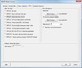
- ADCIRC MC Wind.jpg 732 × 611; 64 KB
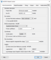
- ADCIRC MC-AdvancedControl.png 521 × 322; 22 KB
- ADCIRC MC-General.png 516 × 604; 30 KB
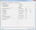
- ADCIRC MC-HarmonicAnalysis.png 878 × 612; 40 KB
- ADCIRC MC-ModelFormulation.png 582 × 815; 43 KB
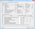
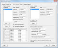
- ADCIRC MC-NodalAttributes.png 877 × 376; 30 KB
- ADCIRC MC-Output.png 515 × 792; 35 KB
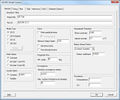
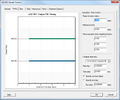
- ADCIRC MC-Timing.png 808 × 396; 20 KB
- ADCIRC MC-Wind.png 668 × 402; 21 KB
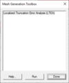
- ADCIRC MeshGenerationToolbox.png 272 × 325; 5 KB
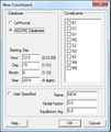
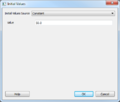
- ADCIRC NewConstituent.jpg 334 × 397; 45 KB
- Adcirc nodestrings.jpg 446 × 405; 49 KB
- ADCIRC Normal BC.jpg 321 × 186; 13 KB
- ADCIRC pipe.png 398 × 294; 6 KB
- ADCIRC recording station.jpg 358 × 288; 21 KB
- ADCIRC RecordingStations.png 398 × 270; 7 KB
- ADCIRC RemoveWeir.png 356 × 195; 17 KB
- ADCIRC Simulation.png 211 × 268; 13 KB
- ADCIRC WettingDryingParameters.png 285 × 150; 12 KB
- Adcirc-flow-att.png 516 × 448; 11 KB
- ADCIRC-MC-Advanced.png 479 × 305; 14 KB
- ADCIRC-MC-Output.png 836 × 602; 35 KB
- Adcirc-tidal-att.png 516 × 448; 16 KB
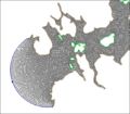
- ADCIRC.PNG 1,440 × 899; 886 KB
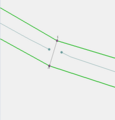
- ADCIRCweir1.jpg 1,043 × 833; 252 KB
- ADCIRCweir2.jpg 969 × 657; 261 KB
- ADCIRCweir4.jpg 687 × 555; 43 KB
- ADCIRCWeir5.jpg 626 × 350; 41 KB
- ADCIRCweirElevations.jpg 296 × 520; 33 KB
- ADCRIC-MC-HarmonicAnalysis.png 705 × 684; 27 KB
- AmericanSamoaLT12K Zoom.jpg 698 × 454; 131 KB
- AmericanSamoaLT12K.jpg 710 × 462; 104 KB
- AmericanSamoaLT24K Zoom.jpg 680 × 458; 143 KB
- AmericanSamoaLT24K.jpg 710 × 462; 104 KB
- AmericanSamoaPaved Zoom.jpg 691 × 454; 138 KB
- AmericanSamoaPaved.jpg 710 × 463; 110 KB
- CheckLeveeToolResults CrestElevation.png 1,340 × 818; 133 KB
- CheckLeveeToolResults CrestElevation2.png 1,340 × 818; 103 KB
- CheckLeveeToolResults CrestElevation3.png 1,340 × 818; 109 KB
- Effective length2.jpg 809 × 378; 26 KB
- Gapsincheckline.png 928 × 489; 16 KB
- GlacierBay10K.jpg 671 × 587; 132 KB
- GlacierBay20K.jpg 563 × 493; 99 KB
- GlacierBay30K.jpg 563 × 493; 95 KB
- GlacierBayConceptual.jpg 546 × 546; 41 KB
- GlacierBayImage.jpg 545 × 543; 120 KB
- GlacierBayLiinear.jpg 671 × 587; 138 KB
- Incompletecheckline.png 353 × 367; 7 KB
- Intersectionrequiredbuffering.png 562 × 364; 10 KB
- LeProvost Domain.png 867 × 465; 512 KB
- LTEA Harmonics.png 232 × 164; 8 KB
- LTEA Tool dialog first page.png 563 × 334; 13 KB
- LTEA Tool dialog Generate Final Mesh.png 563 × 334; 10 KB
- LTEA Tool dialog Run Type page.png 563 × 334; 10 KB
- LTEA1.jpg 577 × 340; 38 KB
- LTEA2.jpg 577 × 340; 52 KB
- LTEA3.jpg 577 × 340; 36 KB
- LTEA4.jpg 577 × 340; 36 KB
- Multiplecheclineintersection.png 543 × 194; 7 KB
- Nodemultiplelevees.png 647 × 526; 34 KB
- Partialunusedcheckline.png 277 × 190; 3 KB
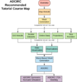
- SMS ADCIRC TutorialCourse.svg 1,041 × 1,102; 85 KB
- SMSSpatialAtt.jpg 715 × 421; 44 KB
- SpatialAttsInitialValues.PNG 457 × 388; 22 KB
- Storm Track Node Attributes.png 554 × 412; 21 KB
- StormAttributes.png 253 × 333; 9 KB
- Stormpath1.jpg 637 × 435; 16 KB
- Stormpath2.jpg 649 × 494; 19 KB
- Stormpath3.jpg 640 × 471; 20 KB
- Stormpath4.jpg 650 × 478; 20 KB
- Stormpath5.jpg 652 × 465; 21 KB
- Stormpath6.jpg 649 × 452; 18 KB

