Category:WMS General Information: Difference between revisions
From XMS Wiki
Jump to navigationJump to search
(Created page with "Articles related to general information and use of WMS.") |
No edit summary |
||
| (One intermediate revision by the same user not shown) | |||
| Line 1: | Line 1: | ||
Articles related to general information and use of WMS. | Articles related to general information and use of WMS. | ||
[[Category:General Information|WMS]] | |||
Latest revision as of 16:47, 31 January 2017
Articles related to general information and use of WMS.
Subcategories
This category has the following 21 subcategories, out of 21 total.
B
C
- Calculators (8 P, 8 F)
D
F
G
M
O
- WMS Outlets (8 P, 8 F)
P
- WMS Plot (16 P, 24 F)
Q
- WMS Quick Tour (68 P, 94 F)
R
- Reservoirs (4 P)
T
W
Pages in category "WMS General Information"
The following 66 pages are in this category, out of 66 total.
D
H
M
P
W
Media in category "WMS General Information"
The following 64 files are in this category, out of 64 total.
- AboutWMS.jpg 540 × 374; 35 KB
- AddDataCommand.png 183 × 23; 4 KB
- ContaminantConcentration.png 740 × 401; 46 KB
- Embankments.png 773 × 793; 331 KB
- EnableWizard.jpg 434 × 160; 20 KB
- EnableWizard1.jpg 434 × 160; 20 KB
- EnableWizard2.jpg 434 × 160; 21 KB
- GetDataTool1.png 1,059 × 582; 731 KB
- GetDataTool2.png 1,064 × 582; 731 KB
- GoogleEarthKmzAnimExport.png 1,428 × 950; 1.87 MB
- GroundwaterAndSediment.png 877 × 806; 96 KB
- Hy8wms1.PNG 1,414 × 845; 990 KB
- ImportFromWeb-WebServiceOptions.png 508 × 429; 27 KB
- IndexMaps.png 799 × 676; 775 KB
- Interface1.PNG 1,430 × 891; 717 KB
- LandXMLFile.png 1,680 × 1,010; 626 KB
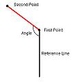
- Measureangle.jpg 243 × 243; 7 KB
- ModClarkModel.jpg 930 × 672; 163 KB
- MultipleScenarios.png 211 × 665; 17 KB
- NexradRainfallGages.jpg 930 × 672; 182 KB
- OmegaEM.zip ; 201 KB
- PlotWindowExample.jpg 592 × 494; 79 KB
- RainfallToGoogleEarth.png 601 × 574; 532 KB
- RasterDataExport.png 336 × 250; 9 KB
- RasterDisplayAndElevationMenu.png 1,260 × 737; 510 KB
- RegisterWizard1.jpg 523 × 443; 50 KB
- RegisterWMS.jpg 488 × 317; 44 KB
- RegisterWMSwindow.jpg 297 × 487; 60 KB
- WMS Film Loop.png 437 × 435; 19 KB
- SmoothStreams.png 503 × 593; 20 KB
- SWMMAttributes.png 1,680 × 1,010; 1.1 MB
- SwmmInterface.jpg 1,400 × 1,300; 417 KB
- TextureMapping.png 1,680 × 1,010; 799 KB
- Units Dialog WMS.PNG 326 × 222; 5 KB
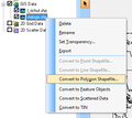
- VectorDataConvert.png 364 × 325; 14 KB
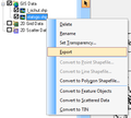
- VectorDataExport.png 357 × 320; 13 KB
- VectorImages.png 1,680 × 1,010; 210 KB
- VectorLuCodes.txt ; 1 KB
- VirtualEarth.png 1,052 × 849; 1.31 MB
- VirtualEarthLocator.jpg 897 × 667; 222 KB
- WelcomeToWMS.jpg 525 × 191; 28 KB
- WMS help strip.png 432 × 50; 3 KB
- WMS Open.jpg 565 × 683; 41 KB
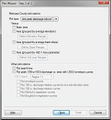
- WMS PlotWizard2.jpg 483 × 521; 69 KB
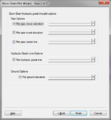
- WMS PlotWizard3.png 483 × 521; 26 KB
- WMS ProjectExplorer1.png 230 × 297; 10 KB
- WMS ProjectExplorer2.png 261 × 175; 28 KB
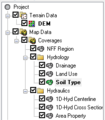
- WMS ProjectExplorer3.png 226 × 258; 8 KB
- WMS PropertiesWindow1.png 221 × 180; 3 KB
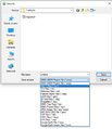
- WMS SaveAs.jpg 558 × 647; 30 KB
- WMS Screen.jpg 1,109 × 689; 311 KB
- Wms-image-library.png 505 × 250; 511 KB
- WMS.PNG 350 × 250; 19 KB
- WMSactive help.png 155 × 52; 4 KB
- WMSDigitize.png 225 × 25; 2 KB
- WMSFlowDirection113.png 418 × 489; 17 KB
- WMSImage313.jpg 396 × 317; 25 KB
- WMSPropertiesWindow.png 302 × 393; 33 KB
- WMSregister1.jpg 297 × 487; 37 KB
- WMSregistration w evaluation.jpg 488 × 143; 17 KB
- WMSregistration w license.jpg 487 × 144; 17 KB
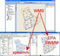
- WmsToXpswmm.jpg 711 × 1,124; 253 KB
- WMSUseDigitizeToolbar.png 1,025 × 526; 255 KB
- XmsWiki.jpg 675 × 564; 67 KB


