WMS:Quick Tour - Join Tables: Difference between revisions
From XMS Wiki
Jump to navigationJump to search
No edit summary |
No edit summary |
||
| (2 intermediate revisions by the same user not shown) | |||
| Line 6: | Line 6: | ||
[[Image: | [[Image:WMS JoinTableShapefile.jpg|600 px]] | ||
[[WMS:Quick Tour - Adding GIS Data without ArcObjects| '''< Previous''']] | [[WMS:Quick Tour - Travel Time Computations | ''' Next >''']] | [[WMS:Quick Tour - Adding GIS Data without ArcObjects| '''< Previous''']] | [[WMS:Quick Tour - Travel Time Computations | ''' Next >''']] | ||
{{WMSQuick}} | |||
[[Category:WMS Quick Tour|J]] | [[Category:WMS Quick Tour|J]] | ||
[[Category:WMS GIS]] | |||
Latest revision as of 15:52, 11 April 2017
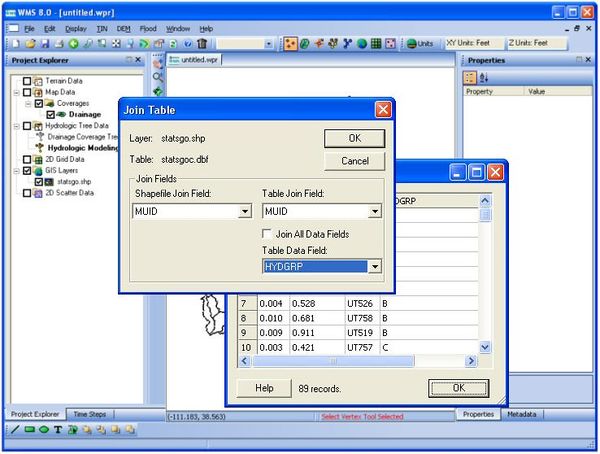
In addition to adding shapefile data to WMS and converting it to feature objects, users can use WMS to join a table to a shapefile's attribute table.
This feature is commonly used to join a separate table of soil attributes to a soil type shapefile in order to compute composite Curve Numbers.


