AHGW:Import GeoVolume from XML: Difference between revisions
From XMS Wiki
Jump to navigationJump to search
(Created page with "thumb|400px|right|XML file structure for representing volumes. The Import GeoVolume from XML tool imports 3D volume feature...") |
m (Move page script moved page AHGW:Import GeoVolume From XML to Test:Import GeoVolume From XML without leaving a redirect) |
(No difference)
| |
Revision as of 23:40, 9 September 2019
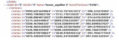
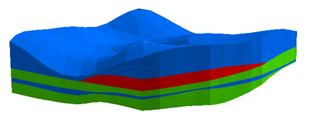
The Import GeoVolume from XML tool imports 3D volume features as 3D multipatches into the GeoVolume feature class in Arc Hydro Groundwater. The tool input is an XML file where volumes are defined as a set of triangles where each triangle is defined by three 3D vertices.
The 3D volumes represent 3D hydrogeologic units and can be viewed in ArcScene.
| [show] AHGW – Arc Hydro Groundwater Toolbox |
|---|


