Category:AHGW Subsurface Analyst
From XMS Wiki
Jump to navigationJump to search
Articles related to the Arch Hydro Groundwater Subsurface Analyst.
Pages in category "AHGW Subsurface Analyst"
The following 92 pages are in this category, out of 92 total.
C
- AHGW:Converting 2D Cross Sections to 3D Using Subsurface Analyst
- User:Rcorrigan/AHGW Pro:Converting 2D Cross Sections to 3D Using Subsurface Analyst
- AHGW:Create 3D Geophysical Plot Features
- AHGW:Create Borelines
- AHGW:Create BorePoints
- AHGW:Create GeoSection Feature Class
- AHGW:Create GeoVolume Feature Class
- AHGW:Create Lithostratigraphy Hydrostratigraphy Display
- AHGW:Create Lithostratigraphy Hydrostratigraphy Feature Classes
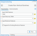
- AHGW:Create Non-Vertical Borelines
- AHGW:Create SectionLine Feature Class
- AHGW:Create XS2D Boreline
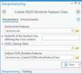
- AHGW:Create XS2D Boreline Feature Class
- AHGW:Create XS2D Borelines
- AHGW:Create XS2D Catalog Table
- AHGW:Create XS2D Geophysical Plot Feature Classes
- AHGW:Create XS2D Geophysical Plot Features
- AHGW:Create XS2D Geophysical Plot Features for Well
- AHGW:Create XS2D Grid
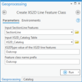
- AHGW:Create XS2D Line Feature Class
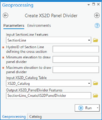
- AHGW:Create XS2D Panel Divider
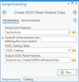
- AHGW:Create XS2D Panel Feature Class
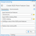
- AHGW:Create XS2D Point Feature Class
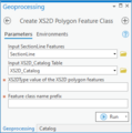
- AHGW:Create XS2D Polygon Feature Class
R
- AHGW:Rasters to GeoSections
- AHGW:Rasters to GeoVolumes
- User:Rcorrigan/AHGW Pro:Borehole Data to Borepoints
- User:Rcorrigan/AHGW Pro:BoreholeLog Table to Points
- User:Rcorrigan/AHGW Pro:Create Borelines
- User:Rcorrigan/AHGW Pro:Create Borepoints
- User:Rcorrigan/AHGW Pro:Create GeoSection Feature Class
- User:Rcorrigan/AHGW Pro:Create GeoVolume Feature Class
- User:Rcorrigan/AHGW Pro:Create Non-Vertical Borelines
- User:Rcorrigan/AHGW Pro:Create SectionLine Feature Class
- User:Rcorrigan/AHGW Pro:Create XS2D Boreline Feature Class
- User:Rcorrigan/AHGW Pro:Create XS2D BoreLines
- User:Rcorrigan/AHGW Pro:Create XS2D Catalog Table
- User:Rcorrigan/AHGW Pro:Create XS2D Geophysical Plot Feature Classes
- User:Rcorrigan/AHGW Pro:Create XS2D Geophysical Plot Features
- User:Rcorrigan/AHGW Pro:Create XS2D Grid
- User:Rcorrigan/AHGW Pro:Create XS2D Line Feature Class
- User:Rcorrigan/AHGW Pro:Create XS2D Panel Divider
- User:Rcorrigan/AHGW Pro:Create XS2D Panel Feature Class
- User:Rcorrigan/AHGW Pro:Create XS2D Point Feature Class
- User:Rcorrigan/AHGW Pro:Create XS2D Polygon Feature Class
- User:Rcorrigan/AHGW Pro:Desurvey Borelog
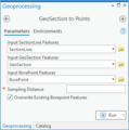
- User:Rcorrigan/AHGW Pro:GeoSection to Points
- User:Rcorrigan/AHGW Pro:HGU Color Manager
- User:Rcorrigan/AHGW Pro:NonVertical Boreline to XS2D
- User:Rcorrigan/AHGW Pro:Polygon to TIN
- User:Rcorrigan/AHGW Pro:Rasters to GeoSections
- User:Rcorrigan/AHGW Pro:Rasters to GeoVolumes
- User:Rcorrigan/AHGW Pro:Reverse Section Line Orientation
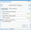
- User:Rcorrigan/AHGW Pro:Scale XS2D Features
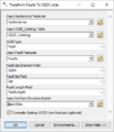
- User:Rcorrigan/AHGW Pro:Transform Faults to XS2D Lines
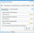
- User:Rcorrigan/AHGW Pro:Transform GeoSection to XS2D Panel
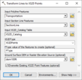
- User:Rcorrigan/AHGW Pro:Transform Lines to XS2D Points
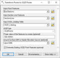
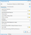
- User:Rcorrigan/AHGW Pro:Transform Points to XS2D Points
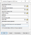
- User:Rcorrigan/AHGW Pro:Transform Polygons to XS2D Lines
- User:Rcorrigan/AHGW Pro:Transform Raster to XS2D Line
- User:Rcorrigan/AHGW Pro:Transform XS2D Lines to Points
- User:Rcorrigan/AHGW Pro:Transform XS2D Panel to GeoSection
- User:Rcorrigan/AHGW Pro:Transform XS2D Well Detail Line
- User:Rcorrigan/AHGW Pro:Transform XS2D Well Detail Polygon
- AHGW:Reverse Section Line Orientation
T
- AHGW:Transform Faults to XS2D Lines
- AHGW:Transform GeoSection to XS2D Panel
- AHGW:Transform Lines to XS2D Points
- AHGW:Transform Points to XS2D Points
- AHGW:Transform Polygons to XS2D Lines
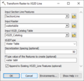
- AHGW:Transform Raster to XS2D Line
- AHGW:Transform XS2D Lines to Points
- AHGW:Transform XS2D Panel to GeoSection
- AHGW:Transform XS2D Well Detail Line
- AHGW:Transform XS2D Well Detail Polygon
Media in category "AHGW Subsurface Analyst"
The following 103 files are in this category, out of 103 total.
- AHGW - GeoSections showing the default clip and fill options.png 866 × 434; 29 KB
- AHGW - Sample horizons ordered by HorizonID values.png 574 × 357; 14 KB
- AHGW - Using the clip option for the top horizon.png 864 × 389; 18 KB
- AHGW - Using the clip option on other horizons.png 864 × 385; 14 KB
- AHGW - Using the fill option on horizons.png 864 × 376; 15 KB
- AHGW 3D borelines visualization.png 440 × 261; 124 KB
- AHGW 3D GeoSection features example.jpg 525 × 290; 23 KB
- AHGW 3D geovolumes Ssa3.png 440 × 280; 80 KB
- AHGW Add Borehole Image Wizard results example v3 2 0.png 828 × 601; 111 KB
- AHGW Attributes of SectionLine dialog example.jpg 680 × 253; 22 KB
- AHGW Attributes XS2D Panel example.jpg 1,192 × 306; 158 KB
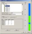
- AHGW Borehole Editor dialog.jpg 597 × 646; 72 KB
- AHGW BoreLines example.jpg 717 × 367; 24 KB
- AHGW Create Non-Vertical Borelines Dialog.png 590 × 260; 13 KB
- AHGW Create XS2D Panel Feature Class dialog.jpg 494 × 234; 37 KB
- AHGW cross section 3.png 440 × 246; 55 KB
- AHGW Desurvey Borelog dialog.png 590 × 706; 31 KB
- AHGW Example XS2D Catalog Table.jpg 552 × 130; 33 KB
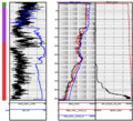
- AHGW geophysical log plot features on an XS2D data frame v3 1 0.png 633 × 355; 11 KB
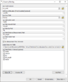
- AHGW Geophysical Plot Tools - AHGW 3 4.png 600 × 545; 231 KB
- AHGW HGU Color Manager dialog example.jpg 824 × 391; 44 KB
- AHGW Import GeoSection From XML 2.jpg 326 × 136; 6 KB
- AHGW Import GeoSection from XML dialog.jpg 486 × 287; 41 KB
- AHGW Import GeoVolume From XML example.jpg 645 × 217; 45 KB
- AHGW Import GeoVolume From XML results.jpg 326 × 134; 6 KB
- AHGW saltwater interface Ssa2.png 440 × 257; 116 KB
- AHGW Subsurface Analyst Features - Borehole Data to Borepoints.png 486 × 630; 35 KB
- AHGW Subsurface Analyst Features - BoreholeLog Table to Points.png 486 × 701; 39 KB
- AHGW Subsurface Analyst Features - Create BoreLines.png 486 × 515; 32 KB
- AHGW Subsurface Analyst Features - Create BorePoints.png 486 × 229; 21 KB
- AHGW Subsurface Analyst Features - Desurvey Borelog.png 486 × 712; 51 KB
- AHGW Subsurface Analyst Features - GeoSection to Points.png 486 × 297; 27 KB
- AHGW Subsurface Analyst Features - Rasters to GeoSections.png 486 × 438; 34 KB
- AHGW Subsurface Analyst Features - Rasters to GeoVolumes.png 486 × 440; 32 KB
- AHGW Subsurface Analyst TIN - Polygon to TIN.png 486 × 272; 23 KB
- AHGW Subsurface Analyst XS2D Editor - Create XS2D Borelines.png 486 × 449; 37 KB
- AHGW Subsurface Analyst XS2D Editor - Create XS2D Catalog Table.png 486 × 232; 20 KB
- AHGW Subsurface Analyst XS2D Editor - Create XS2D Grid.png 486 × 605; 62 KB
- AHGW Subsurface Analyst XS2D Editor - Create XS2D Panel Divider.png 486 × 346; 32 KB
- AHGW Subsurface Analyst XS2D Editor - Scale XS2D Features.png 486 × 241; 23 KB
- ArcGIS Pro Borehole Data to Points.png 321 × 555; 24 KB
- ArcGIS Pro BoreholeLog Table to Points.png 332 × 615; 23 KB
- ArcGIS Pro Create Borelines.png 332 × 615; 24 KB
- ArcGIS Pro Create Borepoints.png 332 × 268; 12 KB
- ArcGIS Pro Create GeoSection Feature Class.png 350 × 268; 12 KB
- ArcGIS Pro Create GeoVolume Feature Class.png 350 × 270; 12 KB
- ArcGIS Pro Create Non Vertical Borelines.png 350 × 339; 14 KB
- ArcGIS Pro Create SectionLine Feature Class.png 328 × 265; 12 KB
- ArcGIS Pro Create XS2D Boreline Feature Class.png 358 × 321; 16 KB
- ArcGIS Pro Create XS2D BoreLines.png 367 × 502; 21 KB
- ArcGIS Pro Create XS2D Catalog Table.png 268 × 219; 10 KB
- ArcGIS Pro Create XS2D Geophysical Plot Feature Class.png 392 × 282; 14 KB
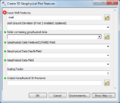
- ArcGIS Pro Create XS2D Geophysical Plot Features.png 325 × 1,035; 39 KB
- ArcGIS Pro Create XS2D Grid.png 386 × 617; 32 KB
- ArcGIS Pro Create XS2D Line Feature Class.png 340 × 340; 16 KB
- ArcGIS Pro Create XS2D Panel Divider.png 337 × 398; 20 KB
- ArcGIS Pro Create XS2D Panel Feature Class.png 330 × 340; 17 KB
- ArcGIS Pro Create XS2D Point Feature Class.png 329 × 331; 15 KB
- ArcGIS Pro Create XS2D Polygon Feature Class.png 326 × 329; 16 KB
- ArcGIS Pro Desurvey Borelog.png 349 × 615; 25 KB
- ArcGIS Pro GeoSection to Points.png 349 × 352; 16 KB
- ArcGIS Pro Nonvertical Boreline to XS2D.png 294 × 398; 18 KB
- ArcGIS Pro Polygon to TIN.png 406 × 319; 16 KB
- ArcGIS Pro Rasters to GeoSections.png 368 × 498; 21 KB
- ArcGIS Pro Rasters to GeoVolumes.png 406 × 497; 22 KB
- ArcGIS Pro Reverse Section Line Orienation.png 332 × 235; 11 KB
- ArcGIS Pro Scale XS2D Features.png 309 × 296; 14 KB
- ArcGIS Pro Transform Faults to XS2D Lines.png 362 × 514; 22 KB
- ArcGIS Pro Transform GeoSection to XS2D Panel.png 318 × 306; 16 KB
- ArcGIS Pro Transform Lines to XS2D Points.png 327 × 430; 21 KB
- ArcGIS Pro Transform Points to XS2D Points.png 386 × 437; 22 KB
- ArcGIS Pro Transform Polygons to XS2D Lines.png 368 × 460; 22 KB
- ArcGIS Pro Transform Raster to XS2D Line.png 324 × 412; 21 KB
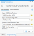
- ArcGIS Pro Transform XS2D Lines to Points.png 301 × 317; 17 KB
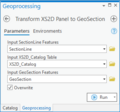
- ArcGIS Pro Transform XS2D Panel to GeoSection.png 326 × 305; 15 KB
- ArcGIS Pro Transform XS2D Well Detail Line.png 326 × 691; 27 KB
- ArcGIS Pro Transform XS2D Well Detail Polygon.png 313 × 711; 28 KB


