Category:WMS Map: Difference between revisions
From XMS Wiki
Jump to navigationJump to search
(Created page with "Articles related to the map module in WMS. M") |
No edit summary |
||
| Line 2: | Line 2: | ||
[[Category:WMS Modules|M]] | [[Category:WMS Modules|M]] | ||
[[Category:Map]] | |||
Revision as of 17:22, 16 November 2016
Articles related to the map module in WMS.
Subcategories
This category has the following 5 subcategories, out of 5 total.
C
- WMS Coverages (19 P, 14 F)
D
- WMS Map Dialogs (11 P, 27 F)
F
- WMS Feature Objects (14 P, 26 F)
M
T
- WMS Map Module Tool Icons (18 F)
Pages in category "WMS Map"
The following 29 pages are in this category, out of 29 total.
1
F
Q
Media in category "WMS Map"
The following 59 files are in this category, out of 59 total.
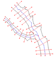
- 1D-CenterlineExample.png 334 × 349; 6 KB
- ArcConstantSpacing100.png 379 × 347; 5 KB
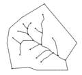
- ArcsBeforeRedistribution.png 416 × 356; 4 KB
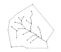
- ArcsConstantInterval5.png 362 × 358; 4 KB
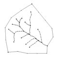
- ArcsSplinedRedistribution.png 371 × 347; 5 KB
- AssignCrossSectionProfile.jpg 445 × 490; 49 KB
- ClassifiedFloodDepthMap.png 375 × 208; 31 KB
- CoverageMenu1.jpg 202 × 198; 18 KB
- CoverageMenu2.jpg 421 × 592; 72 KB
- CoverageMenu3.jpg 204 × 198; 19 KB
- Create Points Tool.svg 45 × 41; 2 KB
- Create Vertices tool.png 16 × 16; 330 bytes
- DelineatedFloodPlainDepthContours.png 367 × 221; 55 KB
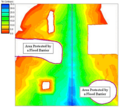
- DelineationFloodBarrier.png 343 × 307; 39 KB
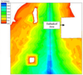
- DelineationFlowPaths.png 341 × 307; 35 KB
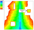
- DelineationNoConsideration.png 344 × 308; 34 KB
- FloodDepthCoverage.png 200 × 520; 14 KB
- LandUseAtts.png 652 × 581; 54 KB
- Map Module Icon.svg 52 × 56; 4 KB
- Map Module.png 16 × 16; 597 bytes
- MapModuleExample.png 380 × 487; 16 KB
- PolygonGrid.png 435 × 409; 8 KB
- RiverCrossSectionAtt.jpg 348 × 391; 32 KB
- RiverReachAtt.png 319 × 406; 7 KB
- SampleTIN DelineationOptions.png 302 × 299; 109 KB
- Select Object tool.png 9 × 16; 339 bytes
- Select Object Tool.svg 26 × 51; 2 KB
- SoilAtts.png 652 × 528; 13 KB
- SWMMHydraulicSchematicFromStormDrainConceptualModel.jpg 478 × 412; 55 KB
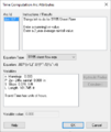
- TimeComputationsArcAttributes .png 380 × 450; 22 KB
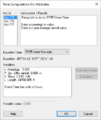
- TimeComputationsArcAttributes2.png 380 × 450; 23 KB
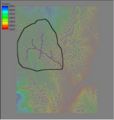
- Tin2.jpg 350 × 367; 28 KB
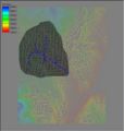
- Tin3.jpg 350 × 368; 31 KB
- WMS - Assign Cross Section dialog.png 486 × 611; 22 KB
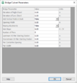
- WMS - Bridge Culvert Parameters dialog.png 458 × 497; 18 KB
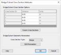
- WMS - BridgeCulvert Cross Section Attributes dialog.png 407 × 367; 12 KB
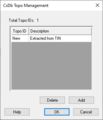
- WMS - CsDb Topo Management dialog.png 298 × 347; 4 KB
- WMS - Line Property Types dialog.png 542 × 308; 6 KB
- WMS - Point Property Types dialog.png 542 × 308; 6 KB
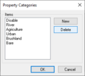
- WMS - Property Categories dialog.png 262 × 235; 4 KB
- WMS - River Cross Section Attributes dialog.png 352 × 537; 13 KB
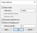
- WMS Clean Options.png 260 × 234; 7 KB
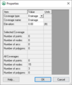
- WMS Coverage Properties.png 321 × 378; 7 KB
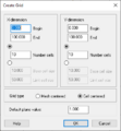
- WMS Create Grid.jpg 356 × 385; 8 KB
- WMS Extract Features.png 1,170 × 792; 226 KB
- WMS MapProjectExplorer1.png 225 × 92; 3 KB
- WMS MapProjectExplorer2.png 230 × 91; 4 KB
- WMS MapProjectExplorer3.png 365 × 461; 21 KB
- WMS SelectArcTool.svg 60 × 60; 3 KB
- WMS SelectLineBranchTool.svg 56 × 60; 157 KB
- WMS SelectPoints.svg 56 × 59; 3 KB
- WMS SelectPolygonTool.svg 60 × 56; 4 KB
- WMS SelectVertexTool.svg 60 × 66; 4 KB
- WMSIcon Map Palette.png 216 × 26; 3 KB
- WMSIcon Select Feature Arc.png 16 × 16; 513 bytes
- WMSIcon Select Feature Line Branch.png 16 × 16; 757 bytes
- WMSIcon Select Feature Point.png 16 × 16; 502 bytes
- WMSIcon Select Feature Polygon.png 16 × 16; 576 bytes
- WMSIcon Select Feature Vertex.png 16 × 16; 546 bytes
