GMS:UGrid Interpolation
| UGrid Module | |
|---|---|
 | |
| UGrid | |
| Creating and Editing | |
| Viewing Modes | |
| Converting to Other Data Types | |
| Exporting UGrids | |
| UGrid Interpolation | |
| More | |
| Display Options | |
| Tool Palette | |
| Cell Properties | |
| UGrid Commands | |
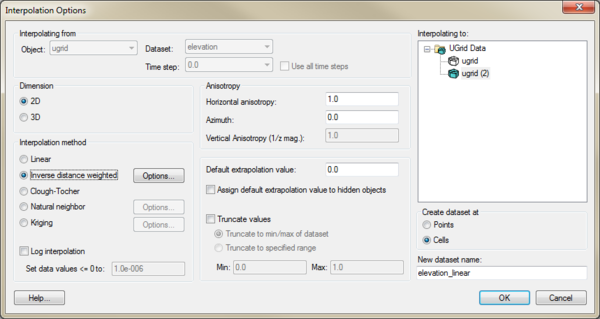
UGrid datasets can be interpolated to other UGrids similar to how scatter point datasets can be interpolated to other objects. The Interpolate To command is found in the right-click menu of the UGrid dataset that the user desires to interpolate to another UGrid. This command opens the following dialog:
This dialog allows selecting the interpolation options to use, and the UGrid to interpolate to. See Interpolation for more information on interpolation.
The user can also drag a UGrid dataset and drop it on to another UGrid to open this dialog and indicate what the interpolation target is.
Points vs. Cells
UGrids can have datasets associated with both cells and points. Thus there is an option to specify where the new dataset will be located: at the points or at the cells.
| GMS – Groundwater Modeling System | ||
|---|---|---|
| Modules: | 2D Grid • 2D Mesh • 2D Scatter Point • 3D Grid • 3D Mesh • 3D Scatter Point • Boreholes • GIS • Map • Solid • TINs • UGrids | |
| Models: | FEFLOW • FEMWATER • HydroGeoSphere • MODAEM • MODFLOW • MODPATH • mod-PATH3DU • MT3DMS • MT3D-USGS • PEST • PHT3D • RT3D • SEAM3D • SEAWAT • SEEP2D • T-PROGS • ZONEBUDGET | |
| Aquaveo | ||
