Category:WMS General Information
From XMS Wiki
Jump to navigationJump to search
Articles related to general information and use of WMS.
Subcategories
This category has the following 21 subcategories, out of 21 total.
B
C
- Calculators (8 P, 8 F)
D
F
G
M
O
- WMS Outlets (8 P, 8 F)
P
- WMS Plot (16 P, 24 F)
Q
- WMS Quick Tour (68 P, 94 F)
R
- Reservoirs (4 P)
T
W
Pages in category "WMS General Information"
The following 66 pages are in this category, out of 66 total.
D
H
M
P
W
Media in category "WMS General Information"
The following 64 files are in this category, out of 64 total.
- AboutWMS.jpg 540 × 374; 35 KB
- AddDataCommand.png 183 × 23; 4 KB
- ContaminantConcentration.png 740 × 401; 46 KB
- Embankments.png 773 × 793; 331 KB
- EnableWizard.jpg 434 × 160; 20 KB
- EnableWizard1.jpg 434 × 160; 20 KB
- EnableWizard2.jpg 434 × 160; 21 KB
- GetDataTool1.png 1,059 × 582; 731 KB
- GetDataTool2.png 1,064 × 582; 731 KB
- GoogleEarthKmzAnimExport.png 1,428 × 950; 1.87 MB
- GroundwaterAndSediment.png 877 × 806; 96 KB
- Hy8wms1.PNG 1,414 × 845; 990 KB
- ImportFromWeb-WebServiceOptions.png 508 × 429; 27 KB
- IndexMaps.png 799 × 676; 775 KB
- Interface1.PNG 1,430 × 891; 717 KB
- LandXMLFile.png 1,680 × 1,010; 626 KB
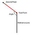
- Measureangle.jpg 243 × 243; 7 KB
- ModClarkModel.jpg 930 × 672; 163 KB
- MultipleScenarios.png 211 × 665; 17 KB
- NexradRainfallGages.jpg 930 × 672; 182 KB
- OmegaEM.zip ; 201 KB
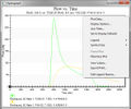
- PlotWindowExample.jpg 592 × 494; 79 KB
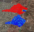
- RainfallToGoogleEarth.png 601 × 574; 532 KB
- RasterDataExport.png 336 × 250; 9 KB
- RasterDisplayAndElevationMenu.png 1,260 × 737; 510 KB
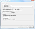
- RegisterWizard1.jpg 523 × 443; 50 KB
- RegisterWMS.jpg 488 × 317; 44 KB
- RegisterWMSwindow.jpg 297 × 487; 60 KB
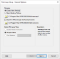
- WMS Film Loop.png 437 × 435; 19 KB
- SmoothStreams.png 503 × 593; 20 KB
- SWMMAttributes.png 1,680 × 1,010; 1.1 MB
- SwmmInterface.jpg 1,400 × 1,300; 417 KB
- TextureMapping.png 1,680 × 1,010; 799 KB
- Units Dialog WMS.PNG 326 × 222; 5 KB
- VectorDataConvert.png 364 × 325; 14 KB
- VectorDataExport.png 357 × 320; 13 KB
- VectorImages.png 1,680 × 1,010; 210 KB
- VectorLuCodes.txt ; 1 KB
- VirtualEarth.png 1,052 × 849; 1.31 MB
- VirtualEarthLocator.jpg 897 × 667; 222 KB
- WelcomeToWMS.jpg 525 × 191; 28 KB
- WMS help strip.png 432 × 50; 3 KB
- WMS Open.jpg 565 × 683; 41 KB
- WMS PlotWizard2.jpg 483 × 521; 69 KB
- WMS PlotWizard3.png 483 × 521; 26 KB
- WMS ProjectExplorer1.png 230 × 297; 10 KB
- WMS ProjectExplorer2.png 261 × 175; 28 KB
- WMS ProjectExplorer3.png 226 × 258; 8 KB
- WMS PropertiesWindow1.png 221 × 180; 3 KB
- WMS SaveAs.jpg 558 × 647; 30 KB
- WMS Screen.jpg 1,109 × 689; 311 KB
- Wms-image-library.png 505 × 250; 511 KB
- WMS.PNG 350 × 250; 19 KB
- WMSactive help.png 155 × 52; 4 KB
- WMSDigitize.png 225 × 25; 2 KB
- WMSFlowDirection113.png 418 × 489; 17 KB
- WMSImage313.jpg 396 × 317; 25 KB
- WMSPropertiesWindow.png 302 × 393; 33 KB
- WMSregister1.jpg 297 × 487; 37 KB
- WMSregistration w evaluation.jpg 488 × 143; 17 KB
- WMSregistration w license.jpg 487 × 144; 17 KB
- WmsToXpswmm.jpg 711 × 1,124; 253 KB
- WMSUseDigitizeToolbar.png 1,025 × 526; 255 KB
- XmsWiki.jpg 675 × 564; 67 KB


