AHGW:Import GeoSection from XML
From XMS Wiki
Jump to navigationJump to search
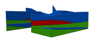
File:AHGW Import GeoSection From XML.jpg
XML file representing 3D cross sections.
The tool imports 3D GeoSection features (3D multipatches) from an XML file. The XML file is structured as a set of SectionLines and GeoSections. The geometry of the SectionLine and GeoSection objects is defined by a set of vertices, where each vertex is defined by X, Y, and Z coordinates.
The GeoSection features created can be viewed in ArcScene.

