GMS:UGrid Viewing Modes
From XMS Wiki
| UGrid Module | |
|---|---|
 | |
| UGrid | |
| Creating and Editing | |
| Viewing Modes | |
| Converting to Other Data Types | |
| Exporting UGrids | |
| UGrid Interpolation | |
| More | |
| Display Options | |
| Tool Palette | |
| Cell Properties | |
| UGrid Commands | |
Single Layer View
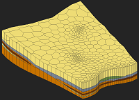
UGrid cells can be assigned to a layer. The layer for the cell is displayed in the Cell Properties. The Single layer toolbar can be used to view one layer at a time. This is somewhat analogous to the 3D Grid ortho mode but works for all viewing angles.
Symbols On Top
When cell faces are turned on, or color filled contours which result in a filled face, the symbols which are normally displayed at the cell centroid are displayed at the center of the top face of the cell. This allows them to be seen, although the symbol may still be partially obscured by the filled cell face.
| GMS – Groundwater Modeling System | ||
|---|---|---|
| Modules: | 2D Grid • 2D Mesh • 2D Scatter Point • 3D Grid • 3D Mesh • 3D Scatter Point • Boreholes • GIS • Map • Solid • TINs • UGrids | |
| Models: | FEFLOW • FEMWATER • HydroGeoSphere • MODAEM • MODFLOW • MODPATH • mod-PATH3DU • MT3DMS • MT3D-USGS • PEST • PHT3D • RT3D • SEAM3D • SEAWAT • SEEP2D • T-PROGS • ZONEBUDGET | |
| Aquaveo | ||