GMS:Map Module: Difference between revisions
From XMS Wiki
Jump to navigationJump to search
No edit summary |
No edit summary |
||
| Line 2: | Line 2: | ||
The Map module provides a suite of tools for using [[GMS:Feature Objects|feature objects]] to build [[GMS:Feature Objects#Conceptual Models|conceptual models]]. | The Map module provides a suite of tools for using [[GMS:Feature Objects|feature objects]] to build [[GMS:Feature Objects#Conceptual Models|conceptual models]]. | ||
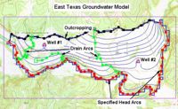
Feature objects are used to provide some GIS-like capabilities within GMS. Feature objects include points, arcs, and polygons. Feature objects can be grouped into layers or [[GMS:Coverages|coverages]]. A set of coverages can be constructed representing a conceptual model of a groundwater modeling problem. This high level representation can be used to automatically generate MODFLOW and MT3DMS | Feature objects are used to provide some GIS-like capabilities within GMS. Feature objects include points, arcs, and polygons. Feature objects can be grouped into layers or [[GMS:Coverages|coverages]]. A set of coverages can be constructed representing a conceptual model of a groundwater modeling problem. This high level representation can be used to automatically generate numerical models such as MODFLOW and MT3DMS. Feature objects can also be used for automated mesh generation. | ||
The Map module is often used as a starting point for many project. Often, a project starts with an image then a coverage is used to create feature object over the image to represent boundaries and structures in the imaged. Then the feature objects are converted to other data types. | |||
[[Image:easttex.jpg|thumb|none|left|500px]] | [[Image:easttex.jpg|thumb|none|left|500px]] | ||

