GMS:Horizons: Difference between revisions
From XMS Wiki
Jump to navigationJump to search
No edit summary |
|||
| (6 intermediate revisions by the same user not shown) | |||
| Line 1: | Line 1: | ||
{{Horizons Links}} | {{Horizons Links}} | ||
The term “horizon” refers to the top of each stratigraphic unit that will be represented in a corresponding | The term “horizon” refers to the top of each stratigraphic unit that will be represented in a corresponding solid, HUF unit, or 3D mesh layer. Horizons are numbered consecutively in the order that the strata are “deposited” (from the bottom up). Horizons can be assigned to [[GMS:Boreholes|boreholes]], [[GMS:TIN Module|TINs]], and [[GMS:Coverages|coverages]]. Beginning with version 9.0, [[GMS:Raster Catalog|raster catalogs]] can also be used to define horizons. | ||
Once horizons have been assigned to boreholes, TINs, and/or [[GMS:Rasters|Rasters]], the [[GMS:Horizons Wizard|''Horizons Wizard'']] can be used to create solids, 3D mesh, or HUF data. | Once horizons have been assigned to boreholes, TINs, and/or [[GMS:Rasters|Rasters]], the [[GMS:Horizons Wizard|''Horizons Wizard'']] can be used to create solids, 3D mesh, or HUF data. | ||
| Line 17: | Line 17: | ||
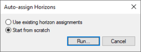
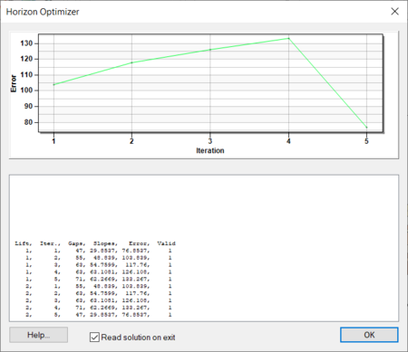
Selecting '''Run''' in the ''Auto-assign Horizons'' dialog will start the ''Horizon Optimizer'' model wrapper. With bigger and more complex sets of boreholes, the optimizer can take a significant amount of time. | Selecting '''Run''' in the ''Auto-assign Horizons'' dialog will start the ''Horizon Optimizer'' model wrapper. With bigger and more complex sets of boreholes, the optimizer can take a significant amount of time. | ||
[[File:Horizons Optimizer.png|thumb|none|450 px|The ''Horizon Optimizer'']] | :[[File:Horizons Optimizer.png|thumb|none|450 px|The ''Horizon Optimizer'' dialog]] | ||
=== Manual Assignment === | === Manual Assignment === | ||
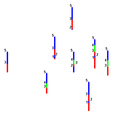
Horizons are defined at borehole contacts (interface between different materials on a borehole log) by double-clicking on a contact with the [[GMS:Borehole Tool Palette|'''Select Contact''']] tool. The ''Contact horizon ID'' dialog is used to manually enter horizon IDs. More than one contact can be selected and assigned the same horizon ID. The [[GMS:Creating and Editing Boreholes#Auto Select|''Boreholes'' | '''Auto Select''']] command can be helpful in assigning horizons to a large group of boreholes. | Horizons are defined at borehole contacts (interface between different materials on a borehole log) by double-clicking on a contact with the [[GMS:Borehole Tool Palette|'''Select Contact''']] tool. The ''Contact horizon ID'' dialog is used to manually enter horizon IDs. More than one contact can be selected and assigned the same horizon ID. The [[GMS:Creating and Editing Boreholes#Auto Select|''Boreholes'' | '''Auto Select''']] command can be helpful in assigning horizons to a large group of boreholes. | ||
{| | :{| | ||
|- | |- | ||
|[[Image:samp_bor.png|thumb|none|400 px|Horizons assigned to contacts on boreholes]] | |[[Image:samp_bor.png|thumb|none|400 px|Horizons assigned to contacts on boreholes]] | ||
| Line 29: | Line 29: | ||
== Assigning Horizons to TINs == | == Assigning Horizons to TINs == | ||
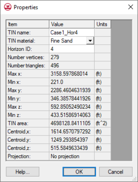
A TIN horizon is assigned in the TIN ''Properties'' dialog. This dialog can be accessed by right-clicking on a TIN in the [[GMS:The GMS Window|Project Explorer]] and selecting the | A TIN horizon is assigned in the TIN ''Properties'' dialog. This dialog can be accessed by right-clicking on a TIN in the [[GMS:The GMS Window|Project Explorer]] and selecting the '''Properties''' command. Each TIN can be assigned one Horizon ID. Each TIN included in the horizons algorithm must have a horizon ID. If wanting to ignore a TIN, this can be done by setting the horizon ID to zero. | ||
[[Image:Hor_Asg_TIN. | :[[Image:Hor_Asg_TIN.png|thumb|none|280 px|Horizons assigned to contacts in TIN ''Properties'' dialog]] | ||
== Assigning Horizons to Rasters == | == Assigning Horizons to Rasters == | ||
