GMS:Map Module: Difference between revisions
From XMS Wiki
Jump to navigationJump to search
No edit summary |
No edit summary |
||
| Line 5: | Line 5: | ||
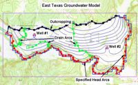
The Map module is often used as a starting point for many project. Often, a project starts with an [[GMS:Images|image]] then, on a coverage, the [[GMS:Feature Object Tool Palette|module tools]] are used to create feature objects over the image to represent boundaries and structures. Then the feature objects are [[GMS:Map to Modules|converted]] to other data types for further processing. | The Map module is often used as a starting point for many project. Often, a project starts with an [[GMS:Images|image]] then, on a coverage, the [[GMS:Feature Object Tool Palette|module tools]] are used to create feature objects over the image to represent boundaries and structures. Then the feature objects are [[GMS:Map to Modules|converted]] to other data types for further processing. | ||
For the purpose of converting feature objects to 2D or 3D grids, the module contains a [[GMS:Grid Frame|grid frame]] tool to define the boundaries and properties of the grid being created. | |||
The Map module also contains its own [[GMS:Feature Object Commands|menu commands]] and its own [[GMS:Feature Object Display Options|display options]]. | The Map module also contains its own [[GMS:Feature Object Commands|menu commands]] and its own [[GMS:Feature Object Display Options|display options]]. | ||

