SMS:1D Hyd Cross Section Coverage
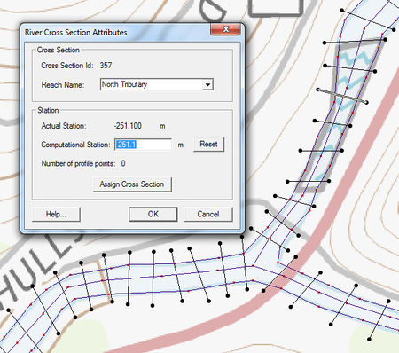
The 1D-Hydraulic Cross Section coverage is used to identify the cross section stations in the hydraulic model, and can also be used to automatically cut a cross section from an underlying digital terrain model. The attributes of a cross section feature arc is the cross section itself, along with the other parameters that define its topology in the model and include: a cross section ID (internally assigned), the reach name (inherited from the centerline arc it intersects), the station (inherited from the centerline), and any specific model attributes. The 1D-Hydraulic coverage is used in conjunction with the cross sections and digital terrain model in order to determine the thalweg position (from the centerline arc) and the left and right bank points (from the bank arcs).
A cross section is assigned automatically when cutting the cross sections, or can be assigned manually (imported from a file or entered directly) using the cross section editor.
See the help for Editing Cross Sections to learn more about how cross sections are managed and edited.
Coverage Specific Right-Click Commands
The 1D Hyd Cross Section Coverage contains all the standard commands in its right-click menu. The coverage also contains a couple specific commands unique to its right-click menu. These commands include:
- Add Arcs to Mesh
- Adds all cross section arcs to an existing mesh.
- Extract cross sections
- Brings up the Extract Cross Sections dialog where a cross section database can be created from the cross sections in the coverage.
- Summary table
- Brings up the Summary Table Options dialog which allows viewing calculations along cross section arcs.
Managing Cross Sections
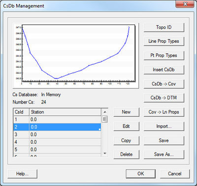
For the new 1D Hydraulic Cross Section coverage, the cross section geometry is stored in text database file on disk. When extracting cross sections they are saved to a new (or existing) database file. This database was the basis for the development of the cross section data in the ArcHydro data model. Cross sections in the database can be used for the development of hydraulic models such as HEC-RAS.
The Manage Cross Sections command allows creating a new database or opening an existing database to add geometries, edit existing ones, and provide proper geo-referencing information. It is also possible to open a cross section database using the Open command from the File menu.
Cross Section Database Definition
When setting up a new database the following attributes can be defined:
- Topo ID – A topographic identifier and description that identifies where the cross section database was derived from. Create a new Topo ID for each database.
- Line Prop Types – By default SMS uses only a Material ID, but other properties could be defined for general use (they will not immediately be used by supported hydraulic models).
- Point Prop Types – By default SMS uses thalweg, left bank, and right bank but other point properties could be defined for general use.
The Cross Section Database Management dialog also allows creating a new cross section; edit, copy, or delete an existing cross section; insert an entire database (merge databases together); convert a cross section database to a coverage (the georeferencing of cross sections must be provided for the cross section to be included in the coverage); create a digital terrain model from the cross section geometry; and converting the coverage to line properties.
Related Topics
SMS – Surface-water Modeling System | ||
|---|---|---|
| Modules: | 1D Grid • Cartesian Grid • Curvilinear Grid • GIS • Map • Mesh • Particle • Quadtree • Raster • Scatter • UGrid |  |
| General Models: | 3D Structure • FVCOM • Generic • PTM | |
| Coastal Models: | ADCIRC • BOUSS-2D • CGWAVE • CMS-Flow • CMS-Wave • GenCade • STWAVE • WAM | |
| Riverine/Estuarine Models: | AdH • HEC-RAS • HYDRO AS-2D • RMA2 • RMA4 • SRH-2D • TUFLOW • TUFLOW FV | |
| Aquaveo • SMS Tutorials • SMS Workflows | ||

