GMS:Solid Primitives
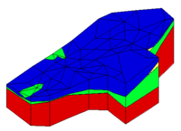
To allow the addition of a trench, building, excavation, tunnel, etc. to a solid model, GMS provides the capability of generating several types of simple solid primitives. The solid primitives can be combined using set operations to model man made objects or other subsurface features which cannot be conveniently modeled by extruding TINs.
Contents
Cube
Simple cubes or, more precisely, hexahedrons whose faces are all parallel to the x, y, and z planes, can be created by selecting the Cube command from the Solids menu and specifying the center point of the cube and the x, y, and z dimensions.
Sphere
A sphere can be created by selecting the Sphere command from the Solids menu and inputting the radius of the sphere, the coordinates of the centroid of the sphere, and the number of subdivisions. The number of subdivisions determines the density of triangles used to approximate the sphere.
Cylinder
A cylinder can be created by selecting the Cylinder command from the Solids menu and inputting the coordinates of both ends of the cylinder, the radius of the cylinder, and the number of subdivisions in the cylinder. The number of subdivisions determines the density of triangles used to approximate the cylinder. The larger the number, the more accurate the representation will be, however the increased number of triangles will also cause display operations to be slower.
Prism
A prism can be created by first putting the image into plan view and then selecting the Prism command from the Solids menu. A prompt then asks to input a polygon. As with other polygons entered in GMS, the Backspace or Delete key can be used to delete the last point entered, the ESC key can be used to abort the process, and double-clicking terminates point entry. A prompt then asks to enter a bottom elevation and a top elevation for the prism. The default values given for the top and bottom elevation represent elevations just above and just below all of the other solids. The polygon is then extruded from the top to the bottom elevation to create a solid object.
| GMS – Groundwater Modeling System | ||
|---|---|---|
| Modules: | 2D Grid • 2D Mesh • 2D Scatter Point • 3D Grid • 3D Mesh • 3D Scatter Point • Boreholes • GIS • Map • Solid • TINs • UGrids | |
| Models: | FEFLOW • FEMWATER • HydroGeoSphere • MODAEM • MODFLOW • MODPATH • mod-PATH3DU • MT3DMS • MT3D-USGS • PEST • PHT3D • RT3D • SEAM3D • SEAWAT • SEEP2D • T-PROGS • ZONEBUDGET | |
| Aquaveo | ||
