GMS:Map Module
From XMS Wiki
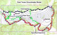
The Map module provides a suite of tools for using Feature Objects to build conceptual models.
Feature objects are used to provide some GIS-like capabilities within GMS. Feature objects include points, arcs, and polygons. Feature objects can be grouped into layers or coverages. A set of coverages can be constructed representing a conceptual model of a groundwater modeling problem. This high level representation can be used to automatically generate MODFLOW and MT3DMS numerical models. Feature objects can also be used for automated mesh generation.
| GMS – Groundwater Modeling System | ||
|---|---|---|
| Modules: | 2D Grid • 2D Mesh • 2D Scatter Point • 3D Grid • 3D Mesh • 3D Scatter Point • Boreholes • GIS • Map • Solid • TINs • UGrids | |
| Models: | FEFLOW • FEMWATER • HydroGeoSphere • MODAEM • MODFLOW • MODPATH • mod-PATH3DU • MT3DMS • MT3D-USGS • PEST • PHT3D • RT3D • SEAM3D • SEAWAT • SEEP2D • T-PROGS • ZONEBUDGET | |
| Aquaveo | ||
Retrieved from "https://www.xmswiki.com/index.php?title=GMS:Map_Module&oldid=55715"

