- This page was last edited on 8 January 2014, at 18:45.
- Privacy policy
- About XMS Wiki
- Disclaimers
| This contains information about functionality available starting at GMS version 10.0. The content may not apply to other versions. |
| UGrid Module | |
|---|---|
 | |
| UGrid | |
| Creating and Editing | |
| Viewing Modes | |
| Converting to Other Data Types | |
| Exporting UGrids | |
| UGrid Interpolation | |
| More | |
| Display Options | |
| Tool Palette | |
| Cell Properties | |
| UGrid Commands | |
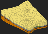
The UGrid module is the newest module in GMS and is used with unstructured grid (UGrid) geometric objects. This type of geometric object is used with MODFLOW-USG and will eventually be used for all the things that 2D Grids and 3D Grids are currently used for.
Interfaces to the following 3D finite difference models are provided in this module:
| [hide]GMS – Groundwater Modeling System | ||
|---|---|---|
| Modules: | 2D Grid • 2D Mesh • 2D Scatter Point • 3D Grid • 3D Mesh • 3D Scatter Point • Boreholes • GIS • Map • Solid • TINs • UGrids | |
| Models: | FEFLOW • FEMWATER • HydroGeoSphere • MODAEM • MODFLOW • MODPATH • mod-PATH3DU • MT3DMS • MT3D-USGS • PEST • PHT3D • RT3D • SEAM3D • SEAWAT • SEEP2D • T-PROGS • ZONEBUDGET | |
| Aquaveo | ||