GMS:Converting TINS to Other Data Types
From XMS Wiki
(Redirected from GMS:TIN to Scatter Points)
Jump to navigationJump to search
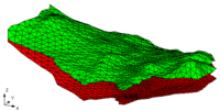
TINs may be converted to other types of data used in GMS, such as a 2D mesh or 2D scatter points. TINs can be converted by right-clicking on the TIN in the Project Explorer, Right-clicking on the TIN in the Graphics Window, or using the following commands in the TIN menu:
- TIN → 2D Scatter Points
- The TIN → 2D Scatter Points command creates a 2D scatter point set from the active TIN . One scatter point is created for each vertex in the TIN. A copy is made of each of the datasets associated with the TIN and the duplicate datasets are stored with the new scatter point set.
- TIN → 2D Mesh
- The TIN → 2D Mesh command creates a 2D finite element mesh from the active TIN . One triangular element is created for each triangle in the TIN. Any datasets associated with the TIN are copied to the new mesh.
- Fill Between TINs → 3D Mesh
- See Creating a 3D Mesh.
- TIN Boundary → Polygons
- This command creates one or more polygons in the active coverage in the Map module corresponding to the outer boundary of the active TIN.
- TIN Thiessen → Polygons
- This command calculates the thiessen polygons from the TIN and converts them to feature polygons.
- TIN → UGrid
- Converts the TIN to a 2D UGrid.
- Vertex Strings → Arcs
- The Vertex Strings → Arcs command creates an arc in the active coverage of the Map module for each of the selected vertex strings.
- Horizons → Solids
- See Horizons → Solids.
- Horizons → 3D Mesh
- See Horizons → 3D Mesh.
| GMS – Groundwater Modeling System | ||
|---|---|---|
| Modules: | 2D Grid • 2D Mesh • 2D Scatter Point • 3D Grid • 3D Mesh • 3D Scatter Point • Boreholes • GIS • Map • Solid • TINs • UGrids | |
| Models: | FEFLOW • FEMWATER • HydroGeoSphere • MODAEM • MODFLOW • MODPATH • mod-PATH3DU • MT3DMS • MT3D-USGS • PEST • PHT3D • RT3D • SEAM3D • SEAWAT • SEEP2D • T-PROGS • ZONEBUDGET | |
| Aquaveo | ||
