GMS:Coverages: Difference between revisions
From XMS Wiki
Jump to navigationJump to search
(→Coverage Setup: Added note on "layer range" and a bit more detail for the "use to define model boundary" option) |
|||
| Line 22: | Line 22: | ||
[[File:CoverageSetup.png|thumb|450 px|Example of the ''Coverage Setup'' dialog]] | [[File:CoverageSetup.png|thumb|450 px|Example of the ''Coverage Setup'' dialog]] | ||
The '''Coverage Setup''' command brings up the ''Coverage Setup'' dialog. This dialog controls the properties that are assigned to feature objects. The feature object properties have been divided into 3 general categories: ''Sources/Sinks/BCs'', ''Areal Properties'', and ''Observation Points''. Under the ''Sources/Sinks/BCs'' the user can select which source/sinks he would like to include in the coverage (like wells, rivers, drains, etc). ''Areal Properties'' includes recharge, ET, hydraulic conductivity, and other properties that are assigned to polygonal zones. ''Observation Points'' control which datasets have associated observation data. | The '''Coverage Setup''' command brings up the ''Coverage Setup'' dialog. This dialog controls the properties that are assigned to feature objects. The feature object properties have been divided into 3 general categories: ''Sources/Sinks/BCs'', ''Areal Properties'', and ''Observation Points''. Under the ''Sources/Sinks/BCs'' the user can select which source/sinks he would like to include in the coverage (like wells, rivers, drains, etc). ''Areal Properties'' includes recharge, ET, hydraulic conductivity, and other properties that are assigned to polygonal zones. ''Observation Points'' control which datasets have associated observation data. | ||
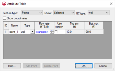
Note about the "Layer range" boundary condition option: the "Layer range" option can be used to apply a boundary condition over one or more layers. When turned on, three column fields are added to the boundary condition attribute table including "Auto assign layer", "From layer", and "To layer". | |||
The ''Coverage type'' is used for WASH123D conceptual models to set the coverage to be a 3D or a 2D coverage. | The ''Coverage type'' is used for WASH123D conceptual models to set the coverage to be a 3D or a 2D coverage. | ||
| Line 27: | Line 29: | ||
The ''Default layer range'' is used with MODFLOW conceptual models to default the "from layer"/"to layer" assignments for boundary conditions. | The ''Default layer range'' is used with MODFLOW conceptual models to default the "from layer"/"to layer" assignments for boundary conditions. | ||
The ''Use to define model boundary'' toggle is used with MODFLOW and MODAEM. This means that the polygons in this coverage are used to define the active area of the model. | The ''Use to define model boundary'' toggle is used with MODFLOW and MODAEM. This means that the polygons in this coverage are used to define the active area of the model. For no flow boundary cells a majority of the cell has to be with a polygon for it to be active. For specified head cells if any portion of the cell is inside a boundary polygon then it is activated. | ||
=== 3D grid layer option for obs. pts === | === 3D grid layer option for obs. pts === | ||


