WMS:Conceptual Model: Difference between revisions
No edit summary |
No edit summary |
||
| (6 intermediate revisions by 2 users not shown) | |||
| Line 1: | Line 1: | ||
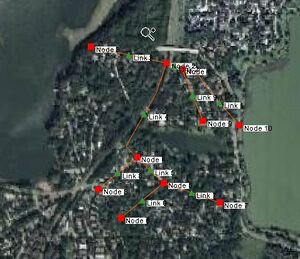
A conceptual model is a map-based representation of | [[File:SWMMHydraulicSchematicFromStormDrainConceptualModel.jpg|thumb|right|A SWMM hydraulic model with arcs representing links and nodes in a SWMM model and the symbols corresponding to links and nodes in the hydraulic schematic.]] | ||
A '''conceptual model''' is a map-based representation of a hydrologic or hydraulic model using [[WMS:Feature Objects|feature objects]] such as points, nodes, arcs, and polygons. A conceptual model is built in the Map module. In many cases, WMS will build the hydrologic or hydraulic model as the conceptual model feature objects are created. As updates are made to the conceptual model, the hydrologic or hydraulic model are automatically updated. | |||
How the conceptual model interacts with the hydrologic or hydraulic model is determined by the coverage type. | |||
[[ | To define and compute lumped-parameter model data, WMS normally converts a map module representation of the model to a schematic- or tree-based representation of the model in either the hydrologic modeling or river module. | ||
*When creating a conceptual model of ''hydrologic'' data (basins, streams, and outlet points), the schematic representation is created automatically. | |||
*When creating a conceptual model of ''hydraulic'' data, the schematic representation is created by selecting the [[WMS:Storm Drain#Storm Drain Menu|'''Map→1D Schematic''']] menu item available in the special menu associated with the hydraulic modeling coverage (This command is available in 1D Hydraulic Schematic and Storm Drain coverages). After selecting the '''Map→1D Schematic''' command, cross sections, reaches, links, and/or nodes are displayed as symbols in the river module and their properties can be edited in that module. | |||
{{WMSMain}} | {{WMSMain}} | ||
[[Category:WMS Map|C]] | |||
[[Category:Conceptual Model]] | |||
Latest revision as of 20:32, 20 December 2019
A conceptual model is a map-based representation of a hydrologic or hydraulic model using feature objects such as points, nodes, arcs, and polygons. A conceptual model is built in the Map module. In many cases, WMS will build the hydrologic or hydraulic model as the conceptual model feature objects are created. As updates are made to the conceptual model, the hydrologic or hydraulic model are automatically updated.
How the conceptual model interacts with the hydrologic or hydraulic model is determined by the coverage type.
To define and compute lumped-parameter model data, WMS normally converts a map module representation of the model to a schematic- or tree-based representation of the model in either the hydrologic modeling or river module.
- When creating a conceptual model of hydrologic data (basins, streams, and outlet points), the schematic representation is created automatically.
- When creating a conceptual model of hydraulic data, the schematic representation is created by selecting the Map→1D Schematic menu item available in the special menu associated with the hydraulic modeling coverage (This command is available in 1D Hydraulic Schematic and Storm Drain coverages). After selecting the Map→1D Schematic command, cross sections, reaches, links, and/or nodes are displayed as symbols in the river module and their properties can be edited in that module.
| [hide] WMS – Watershed Modeling System | ||
|---|---|---|
| Modules: | Terrain Data • Drainage • Map • Hydrologic Modeling • River • GIS • 2D Grid • 2D Scatter |  |
| Models: | CE-QUAL-W2 • GSSHA • HEC-1 • HEC-HMS • HEC-RAS • HSPF • MODRAT • NSS • OC Hydrograph • OC Rational • Rational • River Tools • Storm Drain • SMPDBK • SWMM • TR-20 • TR-55 | |
| Toolbars: | Modules • Macros • Units • Digitize • Static Tools • Dynamic Tools • Drawing • Get Data Tools | |
| Aquaveo | ||
