WMS:Stochastic Modeling: Difference between revisions
No edit summary |
No edit summary |
||
| Line 25: | Line 25: | ||
:7.[[WMS:Post Processing|Post Process the results]] | :7.[[WMS:Post Processing|Post Process the results]] | ||
[[Image: | :[[Image:WMSImage313.jpg|thumb|none|left|300 px]] | ||
[[Image: | :[[Image:WMSImage312.jpg|thumb|none|left|300 px]] | ||
Revision as of 21:05, 20 February 2013
There is always a great deal of uncertainty in hydrologic and hydraulic modeling and the parameters that are used to develop solutions. Despite this, a typical flood plain boundary is black and white in that you are either in or out of the flood plain. A good engineer might be able to dispute a flood plain boundary by performing a hydrologic/hydraulic analysis with a set of equally probable parameters that results in a difference in the flood plain delineation. Until recently, computer programs lacked the ability to consider multiple probable answers and report a probabilistic floodplain boundary, but with the Stochastic Modeling tools in WMS this is possible using a combination of HEC-1 for hydrologic analysis, HEC-RAS for 1D hydraulic river modeling, and the WMS flood plain delineation tools.
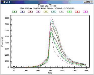
You can "connect" the results of HEC-1 to a developed HEC-RAS model and then run them as many times consecutively, with the results of the HEC-1 analysis feeding the boundary conditions for an HEC-RAS model. Certain parameters (at this point only basin CN and precipitation within HEC-1, and Manning's roughness within HEC-RAS) can be varied within a range of reasonable values using Monte Carlo or Latin Hypercube simulations in order to create a number of simulations. The results of each HEC-RAS model can then be used to delineate a series of flood plains. The combination of all floodplains can then be examined in order to derive a "probabilistic" flood plain where a region flooded by 100% of the model simulation combinations can be distinguished from an area that is flooded by only 50% of the models as shown in the figure below:
The following steps outline the process for developing a stochastic model of floodplain boundaries using WMS, HEC-1, and HEC-RAS.
Related Topics
WMS – Watershed Modeling System | ||
|---|---|---|
| Modules: | Terrain Data • Drainage • Map • Hydrologic Modeling • River • GIS • 2D Grid • 2D Scatter |  |
| Models: | CE-QUAL-W2 • GSSHA • HEC-1 • HEC-HMS • HEC-RAS • HSPF • MODRAT • NSS • OC Hydrograph • OC Rational • Rational • River Tools • Storm Drain • SMPDBK • SWMM • TR-20 • TR-55 | |
| Toolbars: | Modules • Macros • Units • Digitize • Static Tools • Dynamic Tools • Drawing • Get Data Tools | |
| Aquaveo | ||
