WMS:MWBM Embankment Locations: Difference between revisions
From XMS Wiki
Jump to navigationJump to search
No edit summary |
No edit summary |
||
| Line 14: | Line 14: | ||
{{WMSMWBMModWizard}} | {{WMSMWBMModWizard}} | ||
{{WMSMain}} | {{WMSMain}} | ||
[[Category:WMS Dialogs]] | |||
[[Category:MWBM]] | |||
Revision as of 19:59, 14 November 2014
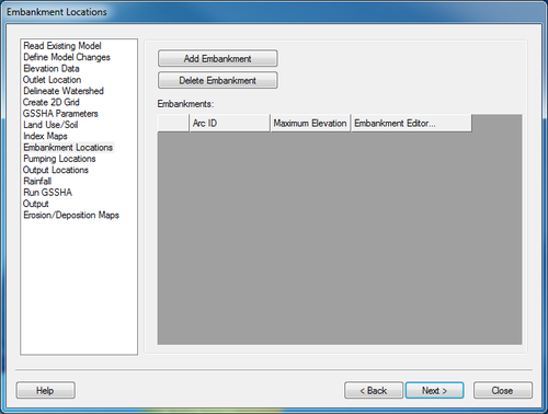
The Embankmnet Locations step is used to layout GSSHA embankment arcs within a watershed. The main spreadsheet shows the existing embankment arcs.
Help
Add Embankment – Turns on the tool to create a GSSHA embankment arc.
Delete Embankment – Turns on the delete arc tool.
Embankment Editor – Launches the Embankment Arc Editor to set the elevations of the embankment.
MWBM Wizard
WMS – Watershed Modeling System | ||
|---|---|---|
| Modules: | Terrain Data • Drainage • Map • Hydrologic Modeling • River • GIS • 2D Grid • 2D Scatter |  |
| Models: | CE-QUAL-W2 • GSSHA • HEC-1 • HEC-HMS • HEC-RAS • HSPF • MODRAT • NSS • OC Hydrograph • OC Rational • Rational • River Tools • Storm Drain • SMPDBK • SWMM • TR-20 • TR-55 | |
| Toolbars: | Modules • Macros • Units • Digitize • Static Tools • Dynamic Tools • Drawing • Get Data Tools | |
| Aquaveo | ||
