WMS:What's new in WMS version 11.0: Difference between revisions
No edit summary |
|||
| (5 intermediate revisions by 2 users not shown) | |||
| Line 1: | Line 1: | ||
The WMS software development team is excited about the release of WMS 11.0! This page lists the exciting new features that have been added to WMS 11.0. | |||
The WMS software development team is excited about the release of WMS | |||
== What's new in WMS 11.0 == | == What's new in WMS 11.0 == | ||
| Line 18: | Line 17: | ||
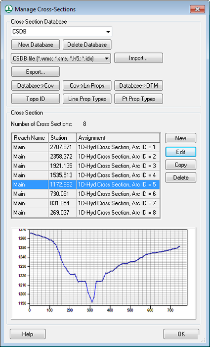
Better support for managing and editing cross section databases for HEC-RAS modeling has been added. A new dialog that allows WMS users to select, manage, and edit cross sections and cross section databases has been implemented. | Better support for managing and editing cross section databases for HEC-RAS modeling has been added. A new dialog that allows WMS users to select, manage, and edit cross sections and cross section databases has been implemented. | ||
:[[Image:CrossSectionDatabase.png|thumb|none|left| | :[[Image:CrossSectionDatabase.png|thumb|none|left|425 px|Cross Section Database]] | ||
=== Support for Reading, Viewing, and Converting LIDAR Data === | === Support for Reading, Viewing, and Converting LIDAR Data === | ||
| Line 29: | Line 28: | ||
Support has been added for the most recent version of HEC-RAS (5.0.3) and the most recent version of HEC-HMS (4.2.1). | Support has been added for the most recent version of HEC-RAS (5.0.3) and the most recent version of HEC-HMS (4.2.1). | ||
The option to import HEC-RAS GIS (.sdf) files has been sped up and improved. | The option to import HEC-RAS GIS (*.sdf) files has been sped up and improved. | ||
=== GSSHA Updates === | === GSSHA Updates === | ||
| Line 41: | Line 40: | ||
=== Higher Resolution Icons === | === Higher Resolution Icons === | ||
Higher resolution icons allow the icon size to be changed. This is done in the ''Preferences'' dialog under the ''General'' tab. | Higher resolution icons allow the icon size to be changed. This is done in the ''Preferences'' dialog under the ''General'' tab. | ||
===Image Crop Collar Option Removed=== | |||
The Crop Collar command is no longer available for images. | |||
== | == Release Notes == | ||
Visit the [[WMS: | Visit the [[WMS:Release Notes_WMS|WMS release notes page]] to view the list of bugs fixed. | ||
Latest revision as of 23:13, 9 January 2023
The WMS software development team is excited about the release of WMS 11.0! This page lists the exciting new features that have been added to WMS 11.0.
What's new in WMS 11.0
Map Flood Tool
A new Map Flood tool was added to automatically offset 100-year floodplain maps to analyze extreme flood scenarios. This option can be used to define a vertical offset from a baseline 100-year FEMA floodplain map. This vertical offset is used with readily available web service data to automatically delineate a new floodplain and determine a new, wider floodplain boundary that accounts for this offset. These modified floodplain maps can be used to determine the impacts of extreme weather and flood scenarios on existing and proposed roadways and other structures.
Floodplain Delineation Improvements
The floodplain delineation capabilities in WMS 11.0 have been streamlined and improved. In many cases, the floodplain delineation has been sped up by a factor of 10.
Worldwide Elevation Data
Support for Amazon Terrain Tiles has been added to the various Import from Web and Get Data tools in WMS. This service provides high resolution elevation data for the entire world with resolutions as high as 3 meters per pixel.
HEC-RAS Cross Section Database Improvements
Better support for managing and editing cross section databases for HEC-RAS modeling has been added. A new dialog that allows WMS users to select, manage, and edit cross sections and cross section databases has been implemented.
Support for Reading, Viewing, and Converting LIDAR Data
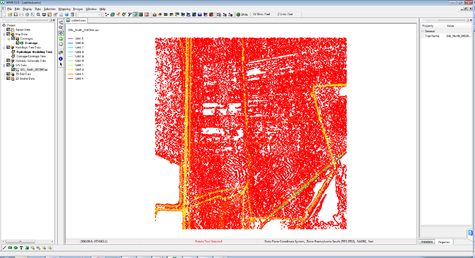
Improved support for reading, viewing, and converting LIDAR data to other formats to use with your model has been added.
HEC-RAS and HEC-HMS Updates
Support has been added for the most recent version of HEC-RAS (5.0.3) and the most recent version of HEC-HMS (4.2.1).
The option to import HEC-RAS GIS (*.sdf) files has been sped up and improved.
GSSHA Updates
Support has been added for the most recent version of GSSHA (7.12).
LandXML Import/Export
Support for reading and writing LandXML files from the hydraulic modeling module for the SWMM, HY12, and EPANET models has been added.
Higher Resolution Icons
Higher resolution icons allow the icon size to be changed. This is done in the Preferences dialog under the General tab.
Image Crop Collar Option Removed
The Crop Collar command is no longer available for images.
Release Notes
Visit the WMS release notes page to view the list of bugs fixed.
WMS – Watershed Modeling System | ||
|---|---|---|
| Modules: | Terrain Data • Drainage • Map • Hydrologic Modeling • River • GIS • 2D Grid • 2D Scatter |  |
| Models: | CE-QUAL-W2 • GSSHA • HEC-1 • HEC-HMS • HEC-RAS • HSPF • MODRAT • NSS • OC Hydrograph • OC Rational • Rational • River Tools • Storm Drain • SMPDBK • SWMM • TR-20 • TR-55 | |
| Toolbars: | Modules • Macros • Units • Digitize • Static Tools • Dynamic Tools • Drawing • Get Data Tools | |
| Aquaveo | ||

