GMS:Add Data: Difference between revisions
From XMS Wiki
Jump to navigationJump to search
No edit summary |
|||
| Line 1: | Line 1: | ||
{{GIS links}} | {{GIS links}} | ||
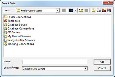
GMS provides two options for adding data: '''Add Shapefile Data''' and '''Add Data'''. The first option can be used without a license of ArcView. The second option is only available with an ArcView License. | GMS provides two options for adding GIS data: '''Add Shapefile Data''' and '''Add Data'''. The first option can be used without a license of ArcView. The second option is only available with an ArcView License. | ||
GIS data cannot be imported using the '''Open''' command unlike most other data types in GMS. | |||
==Add Shapefile Data== | ==Add Shapefile Data== | ||
The ''Data'' | '''Add Shapefile Data''' command allows opening shapefiles as GIS layers in GMS. The command brings up the ''Select Shapefile'' dialog which functions the same as the ''Open'' dialog. Without a license of ArcView on the computer then shapefiles are the only supported format for GIS layers. With a valid license of ArcView the ''Data'' | '''Add Data''' command is available and any of the ESRI supported formats can be opened as GIS data layers. | The ''Data'' | '''Add Shapefile Data''' command allows opening shapefiles as GIS layers in GMS. The command brings up the ''Select Shapefile'' dialog which functions the same as the ''Open'' dialog. Without a license of ArcView on the computer then shapefiles are the only supported format for GIS layers. With a valid license of ArcView the ''Data'' | '''Add Data''' command is available and any of the ESRI supported formats can be opened as GIS data layers. | ||
| Line 14: | Line 16: | ||
[[Category:GIS]] | [[Category:GIS]] | ||
[[Category:GMS GIS Dialogs]] | [[Category:GMS GIS Dialogs]] | ||
