User:Jcreer/WMS:EPANET: Difference between revisions
From XMS Wiki
Jump to navigationJump to search
No edit summary |
|||
| Line 5: | Line 5: | ||
==EPANET Menu== | ==EPANET Menu== | ||
The ''EPANET'' menu has the following commands: | The ''EPANET'' menu has the following commands: | ||
* '''Import EPANET File''' – Brings up an ''Open'' dialog to import an EPANET file (*.inp). | * '''Import EPANET File''' – Brings up an ''Open'' dialog to import an EPANET input file (*.inp). For converting an EPANET network file (*.net) to an input file see . | ||
* '''Export EPANET File''' – Brings up the ''Select an EPANET File'' dialog for exporting a file in EPANET format (*.inp). | * '''Export EPANET File''' – Brings up the ''Select an EPANET File'' dialog for exporting a file in EPANET format (*.inp). | ||
* '''Edit Project Parameters''' – Brings up a ''Properties'' dialog. | * '''Edit Project Parameters''' – Brings up a ''Properties'' dialog. | ||
Revision as of 15:12, 17 January 2017
WMS 10.1 adds support for the EPANET model, a widely used water distribution model. Read GIS data files and map their attributes to the EPANET model attributes, or read and edit existing EPANET models.
EPANET Menu
The EPANET menu has the following commands:
- Import EPANET File – Brings up an Open dialog to import an EPANET input file (*.inp). For converting an EPANET network file (*.net) to an input file see .
- Export EPANET File – Brings up the Select an EPANET File dialog for exporting a file in EPANET format (*.inp).
- Edit Project Parameters – Brings up a Properties dialog.
- Edit Parameters – Brings up the Hydraulic Properties dialog.
- Define Patterns – Define patterns using the XY Series Editor dialog. See XY Series Editor.
- Define Curves – Define curves using the XY Series Editor dialog. See XY Series Editor.
- Assign Ground Elevations – Assign ground elevations.
The commands in the EPANET menu can also be accessed by right-clicking on an EPANET item in the Project Explorer.
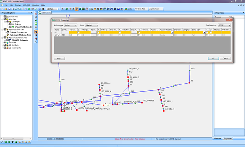
EPANET Properties
EPANET Hydraulic Properties
Related Topics
WMS – Watershed Modeling System | ||
|---|---|---|
| Modules: | Terrain Data • Drainage • Map • Hydrologic Modeling • River • GIS • 2D Grid • 2D Scatter |  |
| Models: | CE-QUAL-W2 • GSSHA • HEC-1 • HEC-HMS • HEC-RAS • HSPF • MODRAT • NSS • OC Hydrograph • OC Rational • Rational • River Tools • Storm Drain • SMPDBK • SWMM • TR-20 • TR-55 | |
| Toolbars: | Modules • Macros • Units • Digitize • Static Tools • Dynamic Tools • Drawing • Get Data Tools | |
| Aquaveo | ||
